

The African plate is moving north.
It has been moving north for approximately four million years, pressing against the Aegean microplate at a rate of five to six centimetres per year: slow by the standards of human experience, cataclysmic by the standards of everything else. Where the two plates meet, the African plate does not stop. It dives, descending beneath the Aegean at the Hellenic Trench south of Crete, the deepest point in the Mediterranean at 5,267 metres, and as it descends it releases the fluids bound in its rock, and those fluids rise into the mantle above and lower its melting point, and the mantle melts, and the melt rises, and eventually it finds its way to the surface.
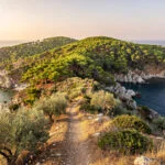
The result, stretched across 500 kilometres of the southern Aegean in a curving chain from Methana in the west to Nisyros in the east, is the South Aegean Volcanic Arc: the geological spine of what we call the Greek islands.
Most visitors to Greece arrive with their attention on the surface: the blue of the Aegean, the whitewashed architecture, the food, the ancient sites. All of these are genuinely extraordinary. But the surface rests on a geological reality that shapes everything above it: the soil composition that gives Santorini its Assyrtiko grapes, the medicinal minerals that made the hot springs of Methana famous from antiquity, the obsidian that Milos supplied to the entire eastern Mediterranean in the Palaeolithic, the catastrophic eruption that may have ended the Minoan civilisation and may have given Plato the material for Atlantis.
The volcanic arc did not simply provide dramatic scenery. It provided the physical conditions that made Greek civilisation possible, and the catastrophes that gave the mythology its deepest structural content.
This is the guide to the places where the earth still breathes fire, and what the fire means.
The Arc Itself | What You Are Standing On
Before the individual sites, the structure deserves its full description, because it changes everything about how you experience the islands above it.
The South Aegean Volcanic Arc has been active since the early Pliocene, approximately 4.7 million years ago, though volcanism intensified significantly during the Quaternary period as the African slab deepened in its subduction and back-arc extension began rifting and thinning the Aegean crust from above. The result is a geological system of considerable complexity: not a single uniform chain of volcanoes but a series of distinct volcanic centres, each with its own history of eruption, caldera formation, dormancy, and renewed activity, each producing rocks of slightly different chemistry reflecting the depth and composition of their magmatic source.
Methana and Aegina anchor the western end of the arc, accessible from Athens, their volcanism expressed in the dozens of craters and domes of the Methana peninsula and the volcanic structures visible across the Saronic Gulf. Milos and Kimolos occupy the central-western segment, their calderas both above and below the sea surface, their volcanic geology producing the extraordinary range of mineral colours that gives Milos its reputation for chromatic variety. Santorini dominates the centre: the most active, the most historically significant, the site of the eruption that reshaped the eastern Mediterranean in approximately 1600 BCE. Nisyros closes the eastern segment, the youngest and most visually immediate of the arc’s volcanic expressions, its caldera formed as recently as the nineteenth century and its crater floor still warm with the energy of the system below.
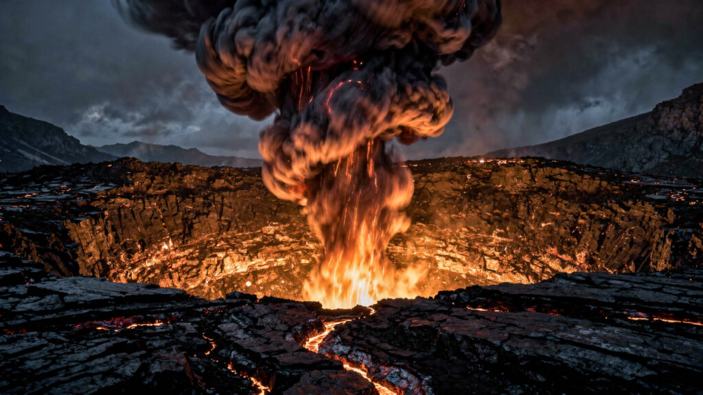
These are not dormant relics. The entire arc is geologically active. Nea Kameni, the central island in the Santorini caldera, has been built by eruptions over the past two thousand years with the most recent activity in 1950. The Kolumbo submarine volcano northeast of Santorini, which erupted catastrophically in 1650 CE and killed seventy people on Santorini from toxic gas, is monitored by continuous seismic arrays. Nisyros’s most recent significant eruption occurred in 1888. Methana last erupted in approximately 230 BCE, within the historical memory of the civilisation that was already recording its mythology in written form.
The Greeks were living on an active volcanic arc, and they knew it. Their mythology encoded this knowledge in the only vocabulary available to a pre-scientific culture: the language of divine agency, of Titans imprisoned beneath mountains, of gods whose forges burned underground, of catastrophes that could only be explained by the anger of beings whose power exceeded any human capacity to resist.
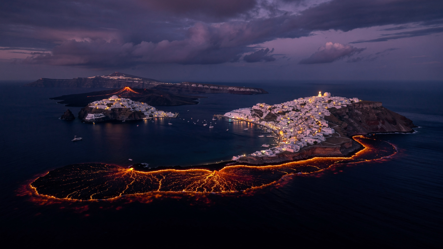
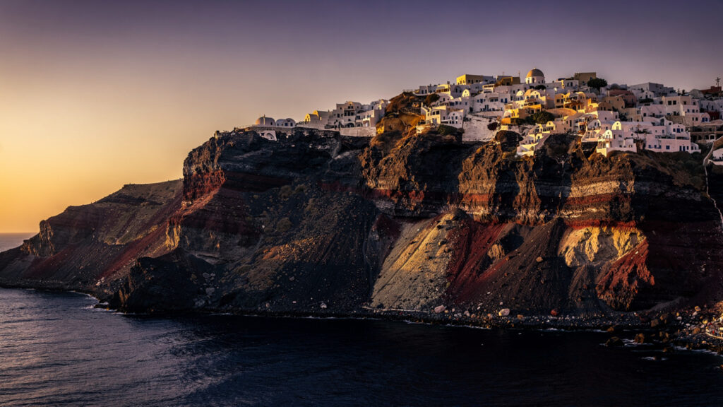
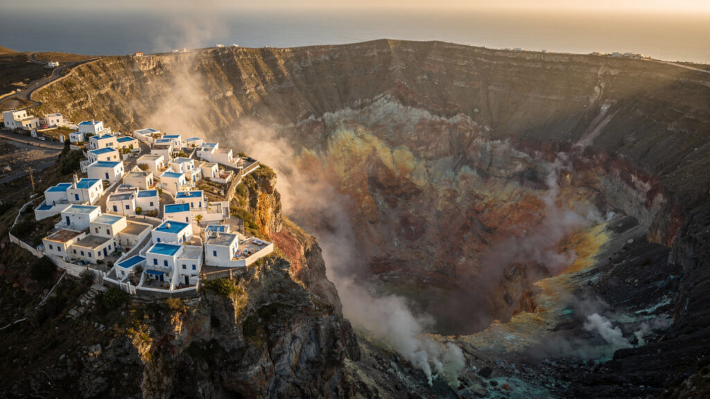
Santorini | Inside the Caldera of a Dead City
Most of the visitors to Santorini are, without knowing it, inside a volcano.
The crescent shape of the main island, the sheer cliffs dropping hundreds of metres to the sea, the small islands of Nea Kameni and Palea Kameni at the centre of the flooded bay: this entire geography is the remnant of a single volcanic edifice whose catastrophic collapse in approximately 1600 BCE created the caldera that the sea now fills to a depth of 390 metres.
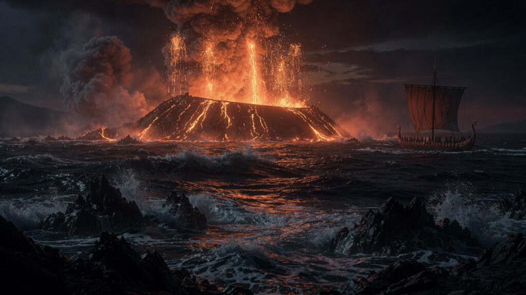
The Minoan eruption of Thera was one of the largest volcanic events in recorded human history. With a Volcanic Explosivity Index of 7, it ejected approximately 60 cubic kilometres of material, roughly four times the volume of Krakatoa’s 1883 eruption. The eruption unfolded in phases: early phreatic explosions provided enough warning that most of the population of Akrotiri apparently evacuated, very few human remains have been found at the buried settlement. Then the main Plinian eruption column rose to a height that deposited pumice across the eastern Mediterranean. Then the caldera collapsed, and the sea rushed in, and the tsunamis generated by the collapse struck the coasts of Crete and the Aegean islands with waves estimated to have reached fifteen to twenty metres in height.
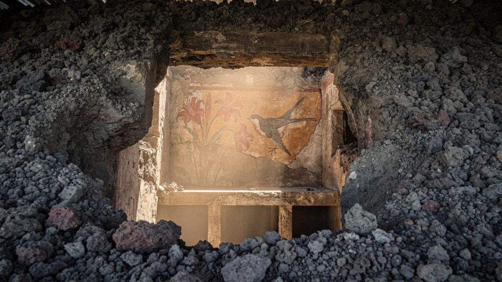
The buried city of Akrotiri, excavated since 1967 and now sheltered under a remarkable protective structure, is the most complete Bronze Age settlement in the Aegean: a city frozen in the moment before its residents fled, its multi-storey buildings intact, its frescoes depicting a cosmopolitan maritime culture of extraordinary sophistication. The paintings of the Flotilla fresco show a fleet of ships moving between harbour towns. The paintings of the Spring fresco show swallows above red lilies in a composition that no subsequent painter has improved on. These were made by people who had no idea that the ground beneath them was storing the energy that would erase their city.
The cliffs above Akrotiri, and all the way around the caldera rim, are the geological record of what happened: layers of pumice and ash and lava in sequences that the volcanologist reads the way an archivist reads a document. Each layer is an event. The lowest visible layers are much older than the Minoan eruption, evidence that the Thera volcanic complex had been building and collapsing long before the Bronze Age settlement that its final collapse destroyed.
Walk the caldera rim at Oia in the early morning, before the crowds arrive, when the light is still low and the water below the cliffs is in shadow. Look at the cliff face rather than the view. The layers in the rock are the eruptions. Each one ended a world and built the material for the next. The island you are standing on was made from the remains of the island that preceded it, and that island from the one before that, in a sequence stretching back four million years.
The sunset at Oia is genuinely extraordinary. It is also the surface of something much older than the buildings that catch the light.
Milos | The Island That Armed the Ancient World
Milos is called the island of colours, and the description is accurate: the volcanic geology of the island produces mineral deposits in such variety that the coastline shifts from white pumice to red iron to yellow sulphur to grey ash in the space of a boat trip, and the effect is more suggestive of an artist’s palette than of a natural landscape.
But the most significant fact about Milos’s volcanic history is not aesthetic. It is practical in the most fundamental sense available to the prehistoric world.
During the Palaeolithic period, Milos was the principal source of obsidian for stone tool production across the entire eastern Mediterranean. Obsidian, volcanic glass produced by the rapid cooling of silica-rich lava, fractures with a predictable sharpness that no other naturally occurring material matches: the edge of an obsidian blade can be sharper than surgical steel, and unlike flint it can be worked into more complex tool forms. Obsidian from Milos has been found at archaeological sites across the Aegean, in Anatolia, in the Levant, and in Egypt: the distribution map of Milos obsidian is a map of the trading networks of the prehistoric Mediterranean, and those networks required boats capable of open-water crossings to reach an island that has always been, as it remains, not straightforwardly accessible.
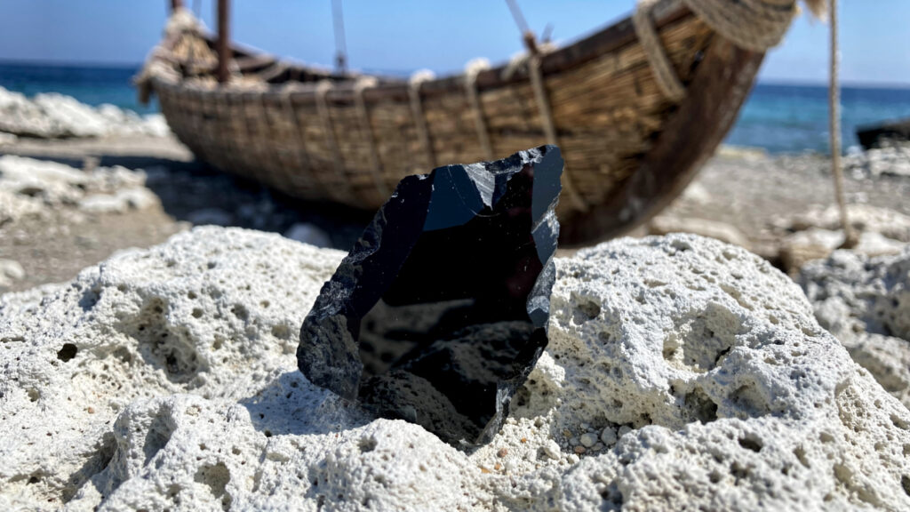
The obsidian trade from Milos is one of the earliest documented examples of maritime commerce in human history. The volcanic island that provided the cutting technology of the Palaeolithic world required the development of the seafaring capacity that would eventually produce the naval traditions of the Greek world.
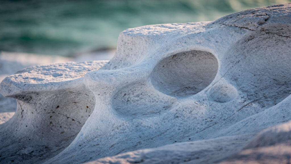
The beach of Sarakiniko, on the north coast, is the most visually immediate encounter with Milos’s volcanic geology: a landscape of bleached white eroded volcanic rock, smooth and curved by wind and wave erosion, that reads as something between a lunar surface and a Henry Moore sculpture at large scale. The light bouncing off the white rock in full summer sun is overwhelming. In the early morning, when the light is lower and the shadows are longer, the landscape has the quality of something that has not yet decided what it is.
The sea caves at Papafragas, narrow inlets where the volcanic rock has been carved by wave action into enclosed channels of emerald water, and the coastal cliffs whose colour changes from sector to sector as different volcanic deposits are exposed, are the rest of the argument: an island whose surface is the geological record of an eruption history spanning millions of years, still visible in real time.
Nisyros | The Living Caldera
Nisyros is the most immediately volcanic island in the Aegean in the sense that matters most: you can walk into the crater and feel the heat rising from the ground.
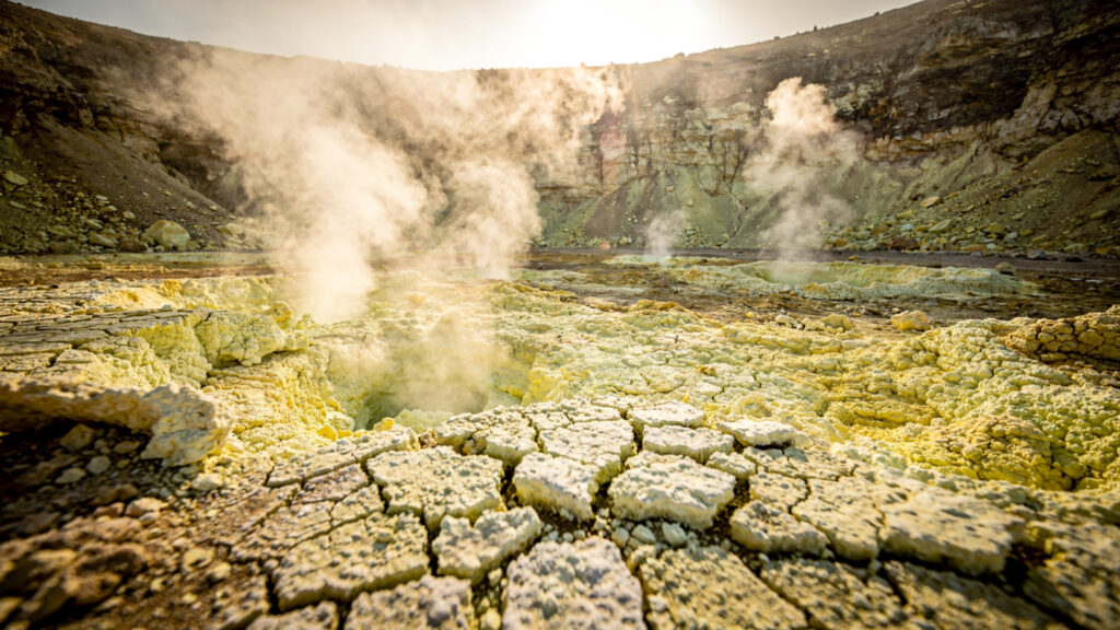
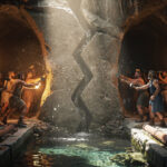
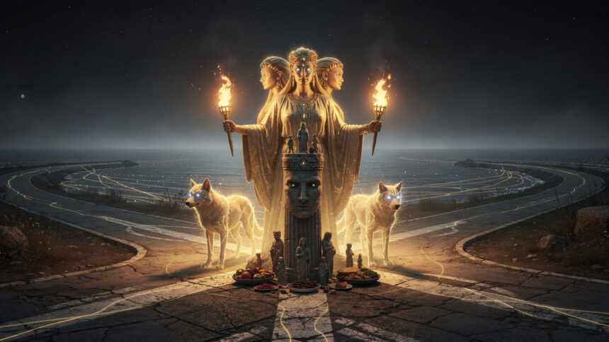
The island is the youngest significant volcanic centre on the arc, its caldera formed by a series of eruptions in the historical period and most recently active in 1888 when the Stefanos crater, the largest and most accessible on the caldera floor, produced its last recorded eruption. The mythology the Greeks built around the island is the most explicit geological encoding in the entire tradition: Poseidon pursued the Titan Polybotes across the sea during the Gigantomachy, the war between the Olympian gods and the giants, and ripped a fragment from the island of Kos and hurled it at him. The rock landed on Polybotes, pinning him beneath it. That rock became Nisyros. The giant’s breathing causes the earthquakes. The heat of his body generates the volcanic activity.
This is not imprecise. It is a precise description, in the available vocabulary, of what the island actually is: a fragment of the geological structure of the region, hurled by the energy of the tectonic system into a configuration, with a living interior whose heat and seismic activity are the direct consequence of the forces that created it.
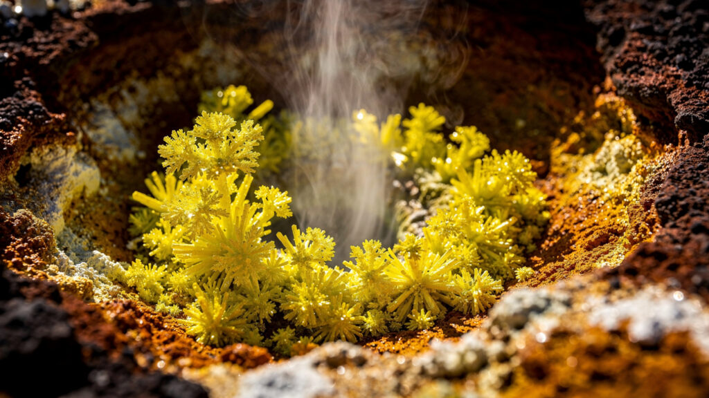
Descend into the Stefanos crater from the caldera floor and the mythology becomes physical experience. The crater is three hundred metres wide, its floor warm underfoot, the air thickened with sulphurous gases that the safety briefing correctly advises you not to inhale at length. Mud pots bubble at the lowest points. Sulphur crystals have formed at the gas vents in yellow and white deposits. The silence between the hissing of the vents is the silence of a place whose interior is doing something that requires attention.
The village of Mandraki on the northern coast, with its Venetian castle and its whitewashed lanes, and the hilltop village of Nikia overlooking the caldera, provide the human measure against which the geological scale of the volcanic system below them becomes fully comprehensible. People have been living on this active caldera for millennia, building villages and fishing harbours and maintaining the ordinary social fabric of an Aegean community directly above a geological system that last expressed itself violently within living memory of the island’s current oldest residents.
This coexistence of ordinary human life and active geological process is the most specifically Greek thing about the volcanic arc: not the drama of the eruptions but the continuous human decision to live on top of them, to name the heat and the shaking, to build mythology around the process, and to keep going.
Methana | The Peninsula of Healing Flames
The Methana peninsula juts into the Saronic Gulf forty kilometres southwest of Athens, connected to the Peloponnese by a narrow isthmus and carrying more than thirty craters and volcanic domes across its rugged terrain.
Methana’s last significant eruption occurred in approximately 230 BCE, documented by the historian Ovid and by Strabo, who described the event with the detail of someone working from eyewitness accounts: a new land mass rising from the sea, fire issuing from the shore, the sea boiling in the vicinity. It is the most precisely documented ancient volcanic eruption in Greece, and it occurred during a period when the civilisation recording it had already been building its philosophical and literary tradition for several centuries.
The hot springs of Methana were known to the ancient world. Pausanias described them in the second century CE. The thermal waters, rising from the volcanic system at temperatures up to forty degrees, carry the mineral load that their passage through the geological structure of the peninsula has given them: sulphur compounds, salts, trace minerals whose therapeutic applications the ancient world identified empirically long before the chemistry that explains them was available. The bathhouses have been operating in some form continuously since antiquity, and the modern spa facilities that occupy the same geological resource are the direct institutional descendants of the Roman bathhouses whose ruins are still visible on the hillside above.
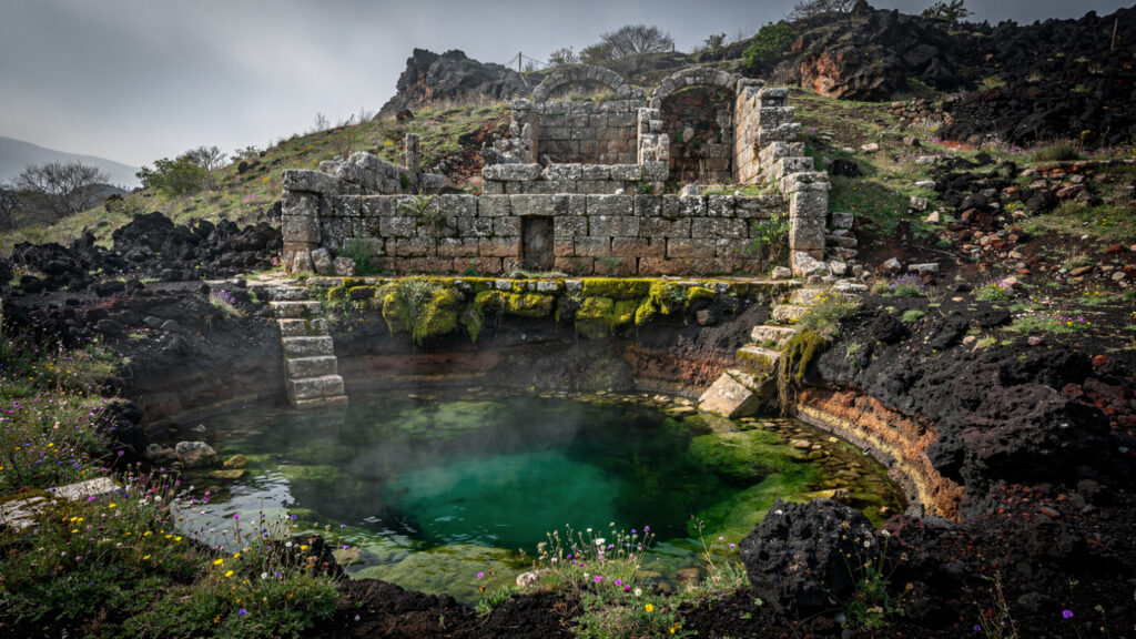
For the visitor based in Athens, Methana is the most accessible demonstration of the volcanic arc’s ongoing activity: two hours by ferry from Piraeus, a landscape of volcanic domes and craters and wildflowers above a coast of secluded beaches, with the hot springs as the most direct physical encounter with the geological system that the entire Aegean sits on top of.
The Mythology the Volcano Made
The Greeks who lived on and around the volcanic arc were not ignorant of what the ground beneath them was doing. They were making sense of it with the most sophisticated intellectual tools available to them.
The Titans imprisoned beneath the earth, whose struggling and breathing causes earthquakes and volcanic eruptions, are the Greek world’s account of the energy stored in the geological system below the Aegean. The Titans are not less real than the tectonic processes that produce seismic and volcanic activity: they are the same reality expressed in a vocabulary that personalised geological force rather than abstracting it into plate mechanics.
Hephaestus at his forge underground, the fire rising from his work visible in the volcanic vents of Lemnos and the Aeolian islands and the Aegean chain, is the Greek account of the magmatic system that the volcanic arc expresses at the surface. The forge is not a metaphor that coincidentally resembles volcanism. It is the Greek mind’s most precise available description of a geological process whose mechanism it could observe at the surface but whose interior workings remained inaccessible.
The Minoan eruption of Thera is the most consequential single geological event in Greek cultural history. Whether it directly caused the decline of the Minoan civilisation is still debated: the eruption almost certainly disrupted agriculture across the eastern Mediterranean through ash fall and climate effects, generated tsunamis that struck Crete, and produced the kind of landscape transformation that the human inhabitants of the affected region spent generations trying to understand and account for. The legend of a great civilisation swallowed by the sea, passed through oral tradition across the centuries between the Minoan catastrophe and Plato, who recorded it in the Timaeus and Critias, may be the cultural memory of the most dramatic event in the human history of the Aegean.
This is not a fantastical claim. It is the most parsimonious explanation for why a philosopher of Plato’s precision and seriousness would devote careful attention to an account of a large island civilisation suddenly destroyed and submerged. He had access to a tradition that preserved the cultural memory of something that had actually happened. The volcanic arc provided the event. The Greek mythological and philosophical tradition provided the framework for remembering it.
Practical Notes for the Volcanic Traveller
Santorini is accessible by ferry from Piraeus in approximately eight hours, and by direct flight from Athens and major European cities. The Nea Kameni volcano tour departs from the old port below Fira multiple times daily in season: it involves a twenty-minute boat crossing and a forty-five minute walk on volcanic terrain where the ground is genuinely warm and the gas vents require the respect the guide’s briefing advises. The Akrotiri archaeological site is open standard hours and the entrance fee is modest relative to what the site contains.
Nisyros is accessible by ferry from Kos or by day-trip boat from Kos and other nearby islands. The caldera descent to Stefanos crater is walkable from the carpark at the caldera rim. The gases are real: move through the lowest sections of the crater without extended stops, and do not visit if you have respiratory conditions that make the sulphurous air problematic.
Milos is accessible by ferry from Piraeus in approximately five to seven hours depending on the service. The coastal boat tours that circumnavigate the island provide the fullest geological picture of the volcanic deposits and are worth the half-day they require.
Methana is accessible by ferry from Piraeus in approximately two hours, making it the most practical day trip from Athens. The spring at Agios Nikolaos is the primary thermal facility and is open to visitors.
The best seasons for volcanic landscape travel are spring and autumn. The summer heat on crater floors and volcanic rock is amplified by the geological activity below, and the combination of forty-degree air temperature and warm ground at Stefanos in August is genuinely extreme. April, May, September, and October provide the clarity of light and the manageable temperatures that the geological landscapes reward.
The Earth is Still Breathing Fire
The African plate will keep moving north.
In ten million years, the Aegean will be a different configuration of land and sea, the volcanic arc will have produced islands that do not yet exist, and some of the islands above the current arc will have been consumed by the system that built them. The geological process that produced Santorini and Nisyros and Milos does not have endings in any timeframe that human culture can fully accommodate.
What the Greeks did with this geological reality is one of the most impressive responses to it available: they looked at the hot springs and the volcanic vents and the earthquake patterns and the caldera collapses and the mineral-rich soils and the obsidian that cut more cleanly than any other material, and they built a civilisation on top of it. They named the forces. They gave the heat a god and the imprisoned energy a mythological narrative and the catastrophes a cultural memory that lasted long enough to reach Plato.
The arc gave them fertile volcanic soils that produced wine and olives of quality. It gave them obsidian that made their ancestors the first maritime traders in the Mediterranean. It gave them geothermal springs whose therapeutic applications they deployed continuously from the Bronze Age through the Roman period. It gave them the landscape drama, the caldera cliffs, the volcanic colours, the warm ground, the sulphur rising, that their mythology required a vocabulary of giants and gods to account for.
And it gave them the epistemological challenge of living on a geological system whose power vastly exceeded any human capacity to control or predict it, which required them to develop, in the mythology and then in the philosophy, the most sophisticated available frameworks for understanding what human beings are in relation to forces that do not answer to them.
That is not a small thing to receive from a tectonic process.
Go to the volcanic arc. Stand in the Stefanos crater and feel the ground warm beneath your feet. Stand on the caldera rim at Santorini and look at the layers in the cliff face below the whitewashed buildings. Find the obsidian on the shores of Milos and hold in your hand the volcanic glass that someone shaped into a cutting tool ten thousand years ago in the same geological material.
The earth is still breathing fire.
It has been doing it for four million years and it will keep doing it long after the buildings above it have returned to the same volcanic rock they were built from.
At Olympus Estate, Wanderlust Greece guides you across the sacred and storied terrain of the Hellenic world. The African plate is moving north at five to six centimetres per year. The South Aegean Volcanic Arc stretches 500 kilometres from Methana to Nisyros. Milos obsidian has been found in Egypt. The Minoan eruption of Thera ejected sixty cubic kilometres of material. Nea Kameni last erupted in 1950. Nisyros erupted in 1888. Methana erupted in 230 BCE and the Greeks wrote it down. Poseidon ripped a fragment from Kos and threw it at Polybotes and it became Nisyros and the giant’s breathing causes the earthquakes. Stand in the Stefanos crater and feel the ground warm beneath your feet. The earth is still breathing fire.


