

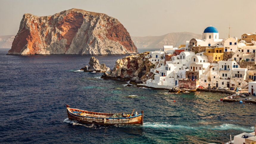
The eruption did not destroy Santorini. It made it.
What the island is now, the caldera, the cliffs, the crescent shape visible from the air, the blue of water that fills the collapsed volcanic crater, the black and red beaches, the white pumice bluffs, the soil that produces the Assyrtiko grape and gives it the mineral sharpness that no other terroir replicates: all of this is the consequence of a volcanic event that occurred around 1600 BCE and was among the most powerful eruptions of the Holocene period. The island that existed before the eruption, called Strongyli, the round one, for its shape, is gone. What remained after the caldera collapsed and the sea filled the void is the island that the world photographs from above and cannot stop returning to.
Understanding Santorini begins with this geological fact rather than with the sunset or the whitewash, because everything distinctive about the island, its landscape, its wine, its architecture, its position in the mythological imagination, follows from what the volcano did. The caldera is not a scenic backdrop. It is the island’s defining event, still present in the form of the water that fills it, the cliffs that rim it, and the two active volcanic islets, Nea Kameni and Palea Kameni, that sit in its center and remind the observant visitor that the geological process that shaped this landscape has not finished.

Santorini, known in antiquity as Thera, is the southernmost major island of the Cyclades, 228 kilometers from Athens by sea, with an area of approximately 76 square kilometers and a coastline of 66 kilometers. The main island, shaped by the eruption into its characteristic crescent, is accompanied by the quieter Thirassia to the west, separated from the main island by a narrow channel, and by Aspronisi to the south. The capital, Fira, sits on the caldera rim at approximately 300 meters above the sea.
The Eruption and the Civilization It Buried
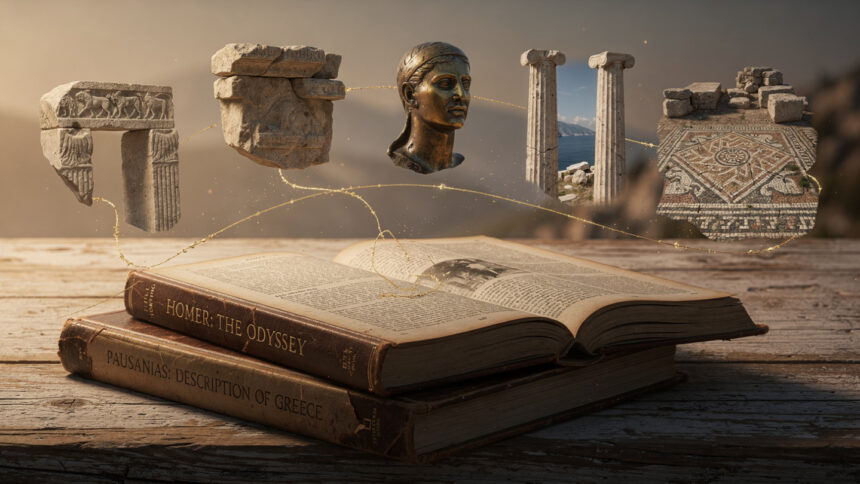
The Minoan settlement at Akrotiri, on the southwestern tip of the island, was buried under volcanic ash by the 1600 BCE eruption and preserved with a completeness that has made it one of the most significant archaeological discoveries in the Aegean world.
The settlement, excavated beginning in 1967 under the direction of Spyridon Marinatos, is a Bronze Age town of considerable sophistication: multi-storey buildings, sophisticated drainage systems, painted frescoes of exceptional quality depicting spring flowers, swallows, fishermen, and the blue monkeys that the Minoan trading networks brought from Egypt. The town was not caught unprepared. The absence of human remains and valuables suggests that the population evacuated before the final eruption, having received warning from the seismic activity that preceded it. They left their furniture, their storage jars, their wall paintings, and the architecture of their daily lives behind.
The frescoes recovered from Akrotiri are among the finest surviving examples of Bronze Age painting anywhere in the Mediterranean. The Spring Fresco, with its red lilies and swooping swallows, captures a moment in the Theran landscape before the eruption with an immediacy that three and a half thousand years have not diminished. The Flotilla Fresco, a long narrative frieze depicting a sea voyage between two towns across a body of water, is the earliest known depiction of a fleet of ships in the ancient world and a document of Minoan maritime culture at its height.
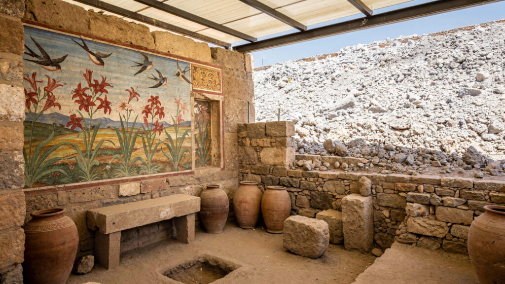
The site is covered by a protective roof structure and is fully accessible to visitors. It is the single most important archaeological experience Santorini offers, and it is consistently underprioritized in comparison to the sunset views and the caldera hotels. The visitor who spends a morning at Akrotiri before going anywhere else on the island will understand what Santorini was before it became what it is, and that understanding changes what the landscape means for the rest of the visit.
The ancient city of Thera, above the beach at Kamari on the island’s southeastern ridge, is a different kind of site: a Hellenistic and Roman settlement on the ridge of Mesa Vouno at 396 meters, accessible by road and by a stepped path from the beach. The ruins here are not preserved at the Akrotiri level, but the position, a city built on a narrow ridge above two seas, the Aegean to one side and the Libyan Sea to the other, is the dramatic expression of what the Theran landscape offered to the people who inhabited it before the modern tourist economy organized the island around the caldera view.
The Caldera and What It Is
The caldera of Santorini is not a lake. It is the sea.
The distinction matters because the sea does not have the contained, passive quality of a lake. The water in the caldera is the Aegean, connected to it through the two channels on either side of Thirassia, moving with the tides and winds that the Aegean produces, carrying the color that the Aegean’s depth and clarity and the volcanic composition of the caldera walls produce when the sun hits it at the angles available from the caldera rim.
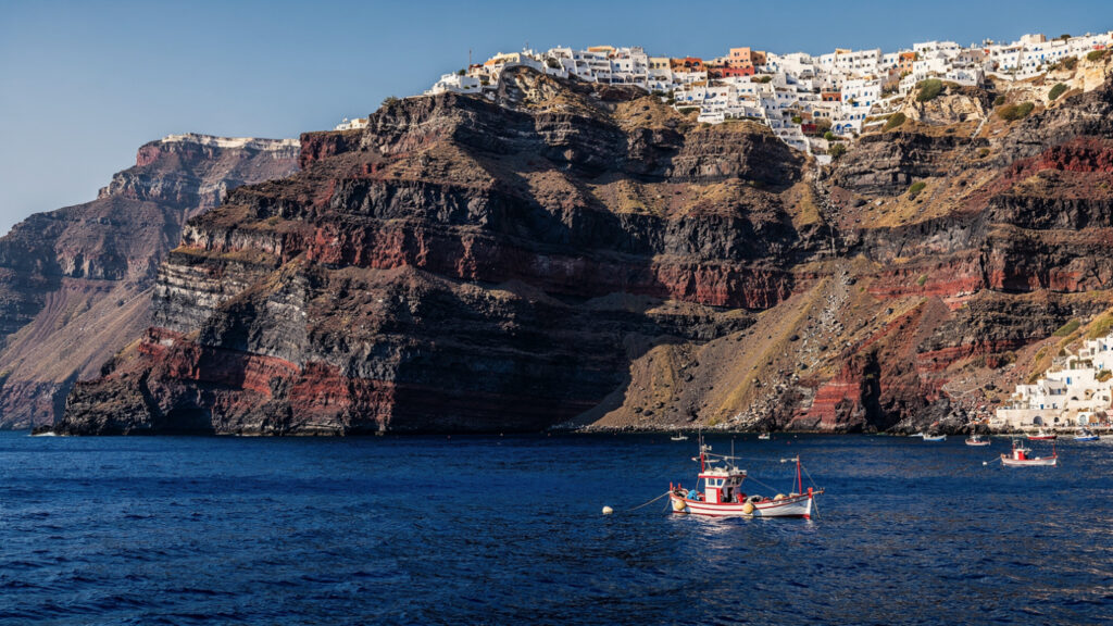
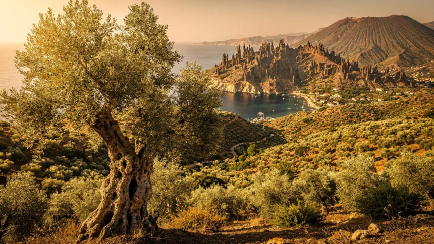
The cliffs that drop from Fira and Oia into the caldera water are between 300 and 400 meters high at their tallest points and composed of the geological layers that the island’s volcanic history has deposited over successive eruptions across hundreds of thousands of years. Reading the cliff face from the water is reading the island’s history in cross-section: the different colored bands of pumice, ash, and lava that each eruptive event deposited, with the most recent catastrophic eruption visible as the thickest and most dramatic layer near the top.
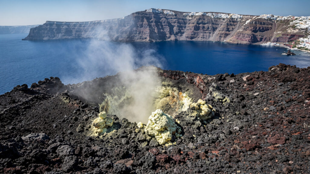
The boat tour of the caldera, departing from the old port below Fira or from Ammoudi Bay below Oia, is the best way to understand the scale of what the eruption produced. From the water, the full circuit of the caldera rim is visible: the white buildings of Fira and Oia and Imerovigli on the cliff edge above, the volcanic islets in the center, and the quality of the caldera water in its different depths and angles of light. The hike to the crater of Nea Kameni, the active volcanic islet, is a twenty-minute walk across dark volcanic rock to a summit that still emits sulfur and heat, the most direct available evidence that the geological process that made Santorini what it is has not concluded.
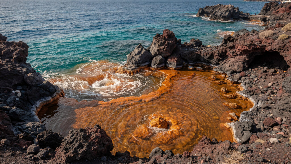
The hot springs at Palea Kameni, the older volcanic islet adjacent to Nea Kameni, are warm enough and sufficiently mineral-rich that the water around the spring vent turns a distinctive orange-brown color where it meets the sea. Swimming at the hot spring is part of the standard caldera boat tour and provides a form of thermal bathing with approximately three thousand years of documented use behind it.
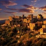
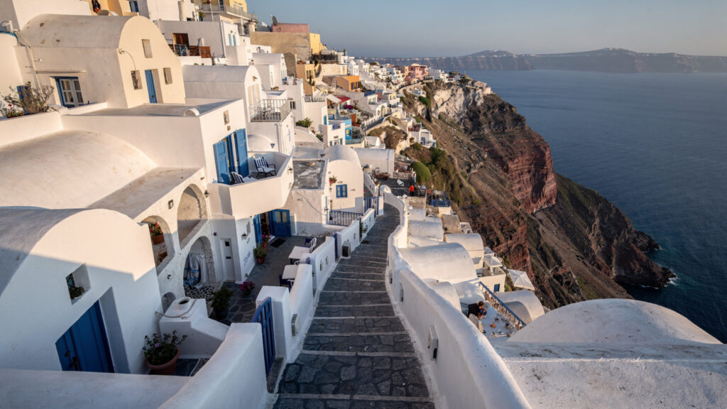
Fira | The Capital on the Rim
Fira, the island’s capital, is built on the caldera rim in a density that the cliff face below it makes dramatic from the water and that the narrow lanes within it make immediately comprehensible to the visitor: this is a town built by people who valued the view over the convenience of moving through it.
The cable car that connects the old port at the base of the cliff to the town above was built in 1979 and operates as the practical alternative to the donkey path that the pre-cable car era required visitors to ascend on foot or by animal. Both the cable car and the donkey path are still in use. The cable car is faster. The path, which the donkeys descend regularly and leave in the condition that working animal paths acquire, is part of the old port experience rather than a recommended choice for the visitor in clean footwear.
The Archaeological Museum of Thera and the Museum of Prehistoric Thera, both in Fira, hold the material record of the island’s occupation from the Cycladic period through the classical era and the Akrotiri finds respectively. The Museum of Prehistoric Thera contains frescoes and objects from the Akrotiri excavation that are displayed in the museum rather than at the site, and the fresco collection is essential viewing for anyone who wants to understand the quality of what the Bronze Age Therans produced. The miniature frieze depicting the sea voyage, held in the museum, is one of the most remarkable objects in the Cycladic archaeological record and receives a fraction of the attention given to the sunset at Oia.
The commercial and social life of Fira is organized around the main pedestrian street that runs along the caldera rim and the lanes that branch from it into the town. The density of the visitor economy in peak season makes Fira the most crowded point on the island, and the visitor who wants to experience the town’s spatial character, the particular quality of walking lanes between whitewashed walls with the caldera visible at the end of each opening, should do so in the early morning before the cruise ship passengers arrive from the port.
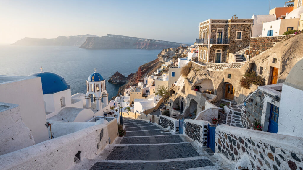
Oia and the Sunset
Oia, on the northern tip of the island, has become the most photographed village in Greece and possibly in the Mediterranean, and the image that it has become famous for, the blue-domed churches above the caldera in the golden light of the late afternoon, is as good as its reputation. The sunset from Oia is genuinely extraordinary: the sun descends toward the horizon above Thirassia and the open sea to the west, and the quality of the light in the final thirty minutes before it reaches the horizon changes the color of the entire caldera in ways that the photographs reproduce but that the direct experience amplifies considerably.
The practical reality of the Oia sunset is that it attracts several thousand people to a limited viewing area every evening in peak season, and the experience of the sunset in a crowd of this density is a different experience from the photographs that the crowd has come to reproduce. The visitor who wants the view without the crowd should arrive at the Byzantine castle ruins at the western end of Oia at least two hours before the scheduled sunset time in July and August, or consider the sunset from Imerovigli or from the caldera rim at Fira, which are both equivalent in visual quality and considerably less congested.
Oia itself, outside the sunset hour, is a village of restored captain’s houses and cave dwellings built into the caldera cliff, connected by lanes that are narrower and quieter than Fira’s and that the village’s partial destruction in the 1956 earthquake has given a character: the rebuilt structures sit alongside the restored ones, and the combination of old and new Cycladic architecture under the same whitewash produces the visual quality that the village photographs from every angle with equal generosity.
The Beaches
The beaches of Santorini are not the reason most visitors come to the island, but they are among the most visually distinctive in the Aegean, because the volcanic geology that produced the caldera also produced beach compositions that no other island in the Cyclades can match.
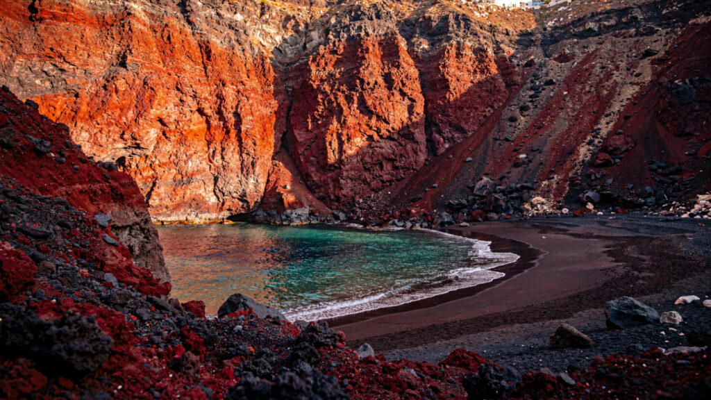
The Red Beach, near Akrotiri on the island’s southwestern coast, is the most dramatic: a cove enclosed by cliffs of red and black volcanic rock, with dark reddish sand at the waterline and the color saturation that the iron oxide content of the volcanic material produces when the sun hits it directly. The beach is accessible by a short path from the road above or by boat from the port at Akrotiri, and its visual quality is at its most intense in the late morning when the sun is high enough to illuminate the cliff faces at full brightness.
The black sand beaches at Kamari and Perissa on the eastern coast are the island’s most developed beach destinations, with the full range of beach club and taverna infrastructure that the eastern coast’s flat terrain and road access permit. The black sand heats significantly more than white sand in the sun, which makes beach shoes advisable in the middle of the day but which also gives the water at the waterline a warmth at the point where it meets the sand that white sand beaches cannot produce.
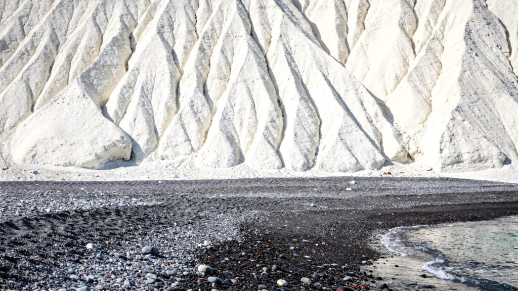
Vlychada, on the southern coast, offers the landscape of the white pumice cliffs that the excavation of pumice for export has left behind: eroded formations of white volcanic material in shapes that the elements have produced over the decades since the quarrying ended, giving the beach a quality that the travel literature accurately describes as lunar. The beach itself is less organized than Kamari or Perissa and the road access requires attention to the road’s condition, but the landscape at Vlychada is unlike any other beach environment in the Cyclades.
The Wine and the Terroir
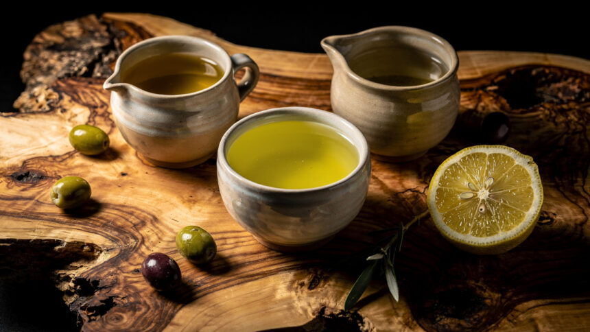
The Assyrtiko grape of Santorini is the clearest single expression of the relationship between the island’s geological character and its agricultural production. The grape is native to the island and grown in the basket-trained bush vine form that the Theran viticulture tradition developed in response to the island’s conditions: low to the ground, coiled in a basket shape that protects the grape clusters from the wind that sweeps across the island’s treeless terrain, drawing water from the volcanic soil’s ability to absorb nighttime humidity rather than from rain that the island’s dry climate does not reliably provide.
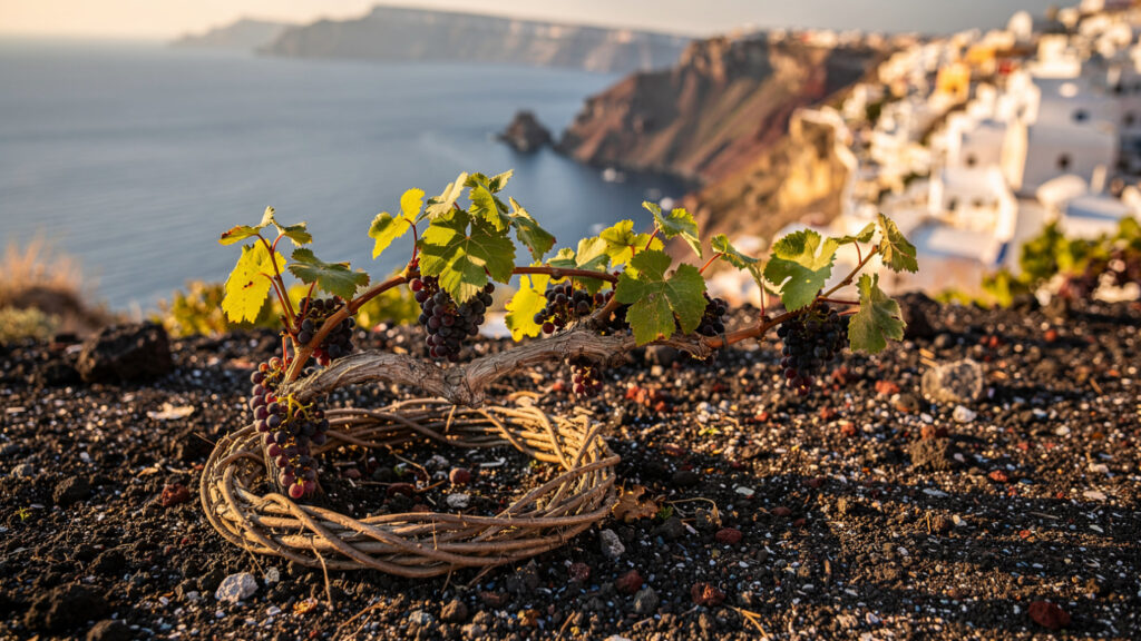
The wine that this combination of grape, soil, and technique produces is dry to the point of austerity, high in acidity, with a mineral and citrus quality that the volcanic soil communicates directly to the vine and through the vine to the wine. It is a white wine that ages exceptionally well for a white wine, developing complexity over years in the way that the mineral structure of the grape allows, and it is the wine that has given Santorini its international reputation in the wine world independently of its reputation as a tourist destination.
Santo Wines, the cooperative winery above Fira, and Estate Argyros and Venetsanos Winery, both on the island’s interior, offer tastings with caldera views in conditions that range from the fully organized tourist wine experience at Santo Wines to the more intimate estate visits at Argyros, where the vineyards themselves are visible and the tasting reflects the production philosophy of a family that has been making Assyrtiko on Santorini for several generations.
The vinsanto of Santorini, made from sun-dried Assyrtiko and Aidani grapes in a process that concentrates the sugar and complexity of the fruit, is the island’s other winemaking legacy: a sweet, amber-colored wine of considerable intensity. The island produced this for the Byzantine and Venetian markets, and contemporary Santorinian producers maintain it in forms that range from the strictly ancestral to modern interpretations. It is not the same wine as the Italian Vin Santo despite the identical name, reflecting instead the island’s own centuries-long practice of sweet wine production.
The Food of Santorini
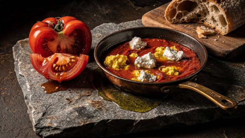
The agricultural products of the island’s volcanic soil produce a cuisine whose character is determined as much by what the terrain grows as by what the culinary tradition has made of it.
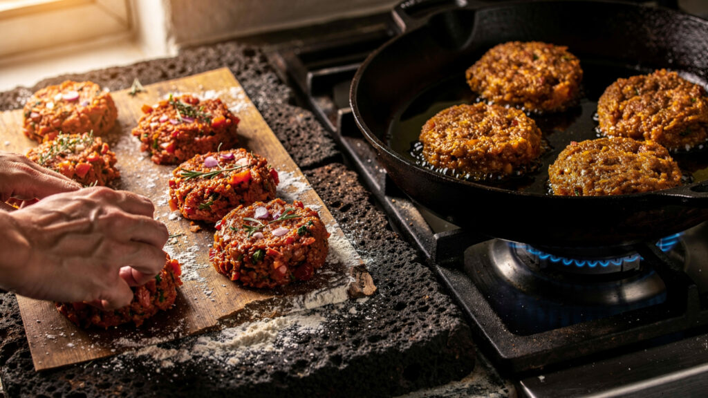
Santorinian tomatoes, grown in the volcanic soil without irrigation, are smaller and drier and more intensely flavored than greenhouse tomatoes or irrigated field tomatoes, and they are the foundation of tomatokeftedes, the fried tomato fritters that are the island’s most characteristic meze: the tomatoes mixed with onion and fresh herbs, formed into small patties, and fried until the exterior is crisp and the interior retains the concentrated sweetness of the sun-dried fruit. The version made from the island’s own tomatoes in season has a flavor density that the tomato fritters made from imported tomatoes in winter do not approach.
Fava, the yellow split pea puree that Santorini produces from the small yellow peas grown in the island’s volcanic soil, is the other product whose terroir character is most directly legible in the finished dish. Santorinian fava is not the same as the fava made from yellow split peas grown elsewhere: the island’s volcanic soil communicates a sweetness and creaminess to the pea that the puree retains, and the dish served at its best, with caramelized onion and a pour of the island’s own olive oil, is a complete argument for the relationship between soil and flavor.
Apochti, the cured pork loin of Santorini made with wine, vinegar, and spices and air-dried in the island’s dry winds, is the island’s characteristic cured meat preparation, developed in the period before refrigeration as a means of preserving pork through the island’s hot summers. The flavor is more complex than most cured pork preparations because the wine and vinegar in the cure add acidity that balances the richness of the fat, and the spice mix that each producer uses is the variant that their family or their village tradition has maintained.
When to Come and How to Move Through It
The island’s peak season runs from late June through August, when the cruise ship traffic and the hotel occupancy combine to produce the density of visitors that makes Santorini both most spectacular and most logistically demanding to navigate. The Oia sunset crowd, the Fira cable car queue, and the Red Beach path are all at their maximum intensity in July and August, and the island’s road network, which does not expand to accommodate the peak season’s additional vehicles, produces the traffic conditions of a small island with too many rental cars.
April and May, and September and October, provide the full range of the island’s experiences at visitor densities that allow the landscape to be perceived without continuous management of the crowd. The Akrotiri site, the caldera boat tour, the Assyrtiko wineries, the beach at Vlychada, and the village lanes of Oia and Pyrgos are all accessible in these months without the organizational effort that August requires.
Pyrgos, the medieval village at the island’s highest point, is the most consistently overlooked town on Santorini and the one that provides the clearest access to what the island’s non-caldera landscape looks like: the stone kasteli, the Byzantine churches, the lanes that predate the tourist economy, and the view from the highest point of the island across the full circuit of sea and caldera that the coastal villages cannot provide because they are in the caldera’s rim rather than above it.
The 1956 Amorgos earthquake, a magnitude 7.5 event distinct from the 1953 earthquake that had devastated Zakynthos and Kefalonia in the Ionian three years earlier, struck the Cyclades directly, killing 53 people and triggering a tsunami that reached the southern coast of Amorgos at a height of roughly 25 meters. The quake damaged much of Santorini’s traditional architecture and accelerated the emigration that had already been reducing the island’s population across the early twentieth century. The rebuilding that followed the earthquake and the tourist development that arrived in the 1970s and accelerated through the 1980s and 1990s produced the Santorini that exists now: an island whose visual identity is the product of both its volcanic geology and its moment of reconstruction at the beginning of the Mediterranean tourism era.
The island that the visitors photograph is genuine. The cliff face, the caldera water, the volcanic beaches, and the Assyrtiko vine in its basket-trained form are all ancient. The whitewash and the infinity pools and the cave hotels are mostly recent. Both layers are present simultaneously, and the visitor who attends to both will understand Santorini more completely than the one who comes only for the photograph that everyone else has already taken.
At Olympus Estate, Wanderlust Greece guides you across the sacred and storied terrain of the Hellenic world, from the Minoan frescoes of Akrotiri buried under the volcano’s ash to the Assyrtiko vine coiled against the same soil that buried them. Santorini is what the eruption made. Everything else is what the people who returned to it built on top.


