Tired of crowded islands? The Greece that most visitors encounter is organized around monuments.
The Parthenon, the Knossos palace, the Delphi sanctuary, the Epidaurus theatre: these are the sites that the tourism infrastructure has been calibrated to deliver, and it delivers them effectively. They are genuinely extraordinary, and the visitor who sees them has encountered some of the most significant surviving material from the ancient world. This collection has dedicated articles to most of them.
But the Greece organized around monuments is the Greece of the sites that have already been identified, excavated, interpreted, and opened to visitors on a schedule. The other Greece, the one that exists in the landscape between the monuments and in the communities that have continued living in that landscape across the millennia since the monuments were built, requires a different kind of itinerary and a different kind of attention.
The five villages in this article are not the most obscure villages in Greece. They are not hidden in the sense of being unknown to the Greek people who live near them or to the category of travelers who seek them out. What they share is the quality of a place where the mythological tradition and the living landscape and the continuing human community are present simultaneously in the same location, in a form that the organized archaeological site cannot provide because the organized archaeological site has been separated from the living community that once inhabited it.
These are places where the myth is still in the landscape and the landscape still has people in it.
Anogia, Crete | The Mountain Above the God’s Birthplace
Anogia sits at 750 meters on the northern slope of Mount Psiloritis, which is Mount Ida of the ancient sources, the highest mountain in Crete and the mountain in whose cave the mythological tradition placed the birth and concealment of Zeus.
The Idaion Andron, the cave on the high plateau of Psiloritis that the ancient tradition identified as the cave where Rhea hid the infant Zeus from Kronos, is accessible from Anogia by the road that climbs to the Nida plateau and from there by a short walk to the cave mouth. The cave is at approximately 1,500 meters, and the approach through the fir forest that covers the upper slopes of Psiloritis in the ecological zone between the grazing altitude and the bare limestone of the summit is the approach through the landscape that the Bronze Age Cretan communities used for the sanctuary that predates the Zeus mythology: the cave was a sacred site in the Minoan period, receiving the bronze shields and the bronze drums and the votive figurines that the excavation documented, before the Greek tradition overlaid the Minoan sacred geography with its own divine genealogy.
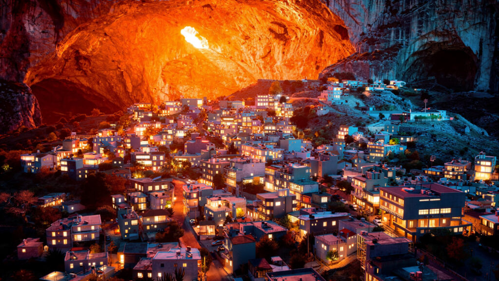
The quality of the Nida plateau in the early morning, before the summer heat has reached the altitude and before the day visitors from the Heraklion hotels have made the drive up the mountain road, is the quality of the Cretan highland landscape that has not yet been organized for the visitor: the plateau meadow with the sheep whose bells are the dominant sound, the cave entrance in the hillside above, and the quality of the Cretan mountain air at altitude in the hours when the light is still at the angle that makes the limestone of the upper Psiloritis catch the sun on its upper faces while the plateau below is still in the shadow of the mountain’s bulk.
Anogia carries a history of resistance that the twentieth century added to its older mythic identity. The village was burned twice by Axis forces during the German occupation of Crete, in 1944 as reprisal for partisan activity, and rebuilt twice by the same community on the same ground. The men of Anogia still appear in Cretan dress, the sariki head‑wrap, the vraka breeches, and the high boots, not as a performance for visitors but as the continuing dress of a community that preserved its identity through occupation, destruction, and rebuilding.
The village’s musical heritage, which produced Nikos Xylouris, the Cretan lyra player who became the most celebrated Cretan musician of the twentieth century, is the living expression of the same cultural depth that the mythology of the Zeus birth cave conveys in another register. The island that was old enough to be remembered as the birthplace of the king of the gods was old enough to have developed a musical world of corresponding richness.
Dimitsana, Arcadia | The Gorge Where the Nymphs Bathed Zeus
Arcadia in the ancient Greek tradition was the region the gods preserved in the condition of the original pastoral world. It was the high, cold, forested plateau of the central Peloponnese, isolated by surrounding mountain ranges, where Pan played his pipes on the mountainside, where the nymphs moved through the forest, and where the river gods inhabited the streams that flowed from the Arcadian highlands into the valleys below.
The Lousios River, named in myth as one of the rivers in which the nymphs bathed the infant Zeus before his concealment in Crete, runs through the most dramatic gorge in the Arcadian interior. It is a narrow limestone gorge whose walls reach roughly three hundred meters in places, cut by the Lousios through the geology of the central Peloponnese long before any human settlement appeared on its edges. The monasteries built into the cliff faces in the eleventh and twelfth centuries, Philosophou, Nea Philosophou, and Prodromos, are the human response to a landscape whose depth and enclosure made it the natural site for the contemplative withdrawal the monastic tradition sought. The gorge was already sacred before the monasteries were built, and the monasteries were built because it was already sacred.
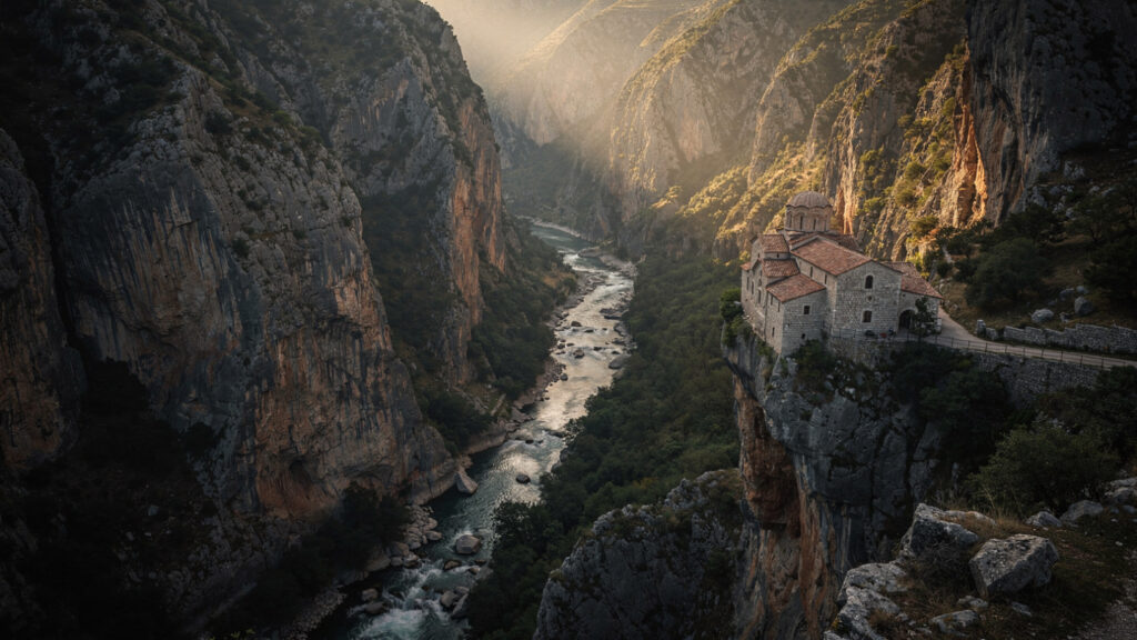
Dimitsana, perched on the ridge above the gorge’s northwestern edge at 900 meters, is the largest of the villages that the Lousios gorge produced and the one with the most complete surviving architecture from the period of its greatest prosperity: the eighteenth and nineteenth century stone houses with their external staircases and their Arcadian architectural character are the houses of the community that was prosperous enough to build in stone in the period when the Peloponnese was still under Ottoman administration. The gunpowder mill that Dimitsana maintained in the gorge below the village was one of the primary suppliers of the Greek independence movement in the 1820s, which gives the village a place in the history of Greek independence alongside its mythological geography.
The path down from Dimitsana into the Lousios gorge, following the river south through its most enclosed section to the monastery of Philosophou and then to the rebuilt Nea Philosophou, is the walk that gives the Arcadian landscape its fullest expression. The sound of the river in the gorge, the Byzantine monasteries built into the cliff faces above, and the quality of the Arcadian light in the depth of the ravine, where the walls filter the sun into the directional glow that deep gorges produce, form the combination the ancient imagination was describing when it placed Pan in these mountains and the nymphs in this river.
Stemnitsa, the silversmithing village six kilometers west of Dimitsana on the same ridge, is the companion settlement whose craft heritage developed alongside the gorge’s religious and military history. The School of Arts of Stemnitsa still teaches the metalworking techniques that the village’s artisans maintained through the Ottoman period and that produced some of the finest ecclesiastical silverwork in the Greek Orthodox world.
Kalarrytes, Epirus | The Silver Village at the Edge of the World
Kalarrytes is accessed by a road that climbs from the Arachthos valley into the Tzoumerka mountains on the southern edge of the Pindus range, and the approach gives the visitor approximately forty minutes of the quality of Epirote mountain road that separates Kalarrytes from the ordinary world: the road narrows and the gorge deepens and the limestone formations of the Tzoumerka become more extreme in their geology the higher the road climbs, until the village appears on a shoulder of the mountain at approximately 1,100 meters above the valley that the road has been ascending.
The village was one of the most prosperous communities in the Ottoman-era Epirus: the Vlach-speaking semi-nomadic shepherds who wintered in the warmer lowlands and summered in the Tzoumerka highlands developed the silversmithing tradition that gave Kalarrytes its prosperity and its reputation across the Balkans. The kalfas, the master silversmiths of Kalarrytes, were itinerant craftsmen who traveled the Ottoman world making the ecclesiastical silverwork and the personal jewelry that the Orthodox communities of the Balkans required, returning to Kalarrytes with the wealth that built the quality of stone architecture that still stands in the village’s lanes.
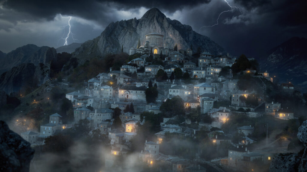
The population of Kalarrytes has contracted substantially from its nineteenth-century peak: the community that maintained hundreds of households in the Ottoman period now has a permanent population of a few dozen elderly residents and the summer population of returned diaspora members and the category of visitor who has made the journey specifically to see what the village is. The emptiness is part of what the village now communicates: the quality of a place whose prosperity has departed and whose architecture remains as the record of the prosperity that is no longer present.
The Pindus mountains around Kalarrytes were understood in the ancient world as the territory where the divine power of the Dodonaean oracle found its earthly expression. The same forces that spoke through the oak at Dodona were believed to move through the Pindus landscape, and the conditions created by the Tzoumerka heights, the thunderstorms that rise over the mountains on summer afternoons, the mountain light in the hours before the storm, and the depth of the silence in the intervals between the storms, were the conditions the ancient imagination was describing when it placed the divine in these mountains.
The road from Kalarrytes to the neighboring village of Matsouki crosses the ridge that separates the two communities and provides the view of the Tzoumerka massif that the village’s own position prevents. The full extent of the limestone formations of the southern Pindus visible from the ridge in the morning light, with the Ionian Sea appearing as a line of brightness on the western horizon on clear days, is the view that makes the isolation of Kalarrytes comprehensible as something more than simply remote. The village chose this altitude and this seclusion for the combination of summer grazing, winter departure, and the security that the inaccessible position offered in the periods of occupation that the Epirote experience had learned to navigate through withdrawal rather than resistance.
Vathia, Mani | The Tower-Village at the Edge of the Underworld
The Mani peninsula is the middle finger of the three peninsulas that the southern Peloponnese extends into the Mediterranean, and Vathia is the tower-village that most completely expresses what the Mani is: a cluster of stone military towers on a bare limestone ridge above the deep blue of the Laconian Gulf, in a landscape that has been producing a kind of human community for as long as any landscape in Greece.
The Mani towers were not built for aesthetics. They were built in the conditions of the blood feud culture that the Mani communities maintained for centuries as the mechanism of justice in a landscape where the Ottoman state had limited authority and where the clans organized their disputes and their alliances through the protocol of the vendetta. The towers were the military architecture of the feud: built to the maximum height that the resources of the building clan could sustain, used to fire down on the neighboring clan’s compound during the active phase of the feud, and maintained as the mark of the family’s standing in the community’s power hierarchy. The village of Vathia, which at its peak supported approximately twenty towers within a few hundred meters of each other, was a community organized around the spatial logic of the vendetta: the towers close enough to be in range of each other’s fire, the lanes between them narrow enough to be defensible, and the entire cluster visible from the sea as the mark of the community’s military capacity.
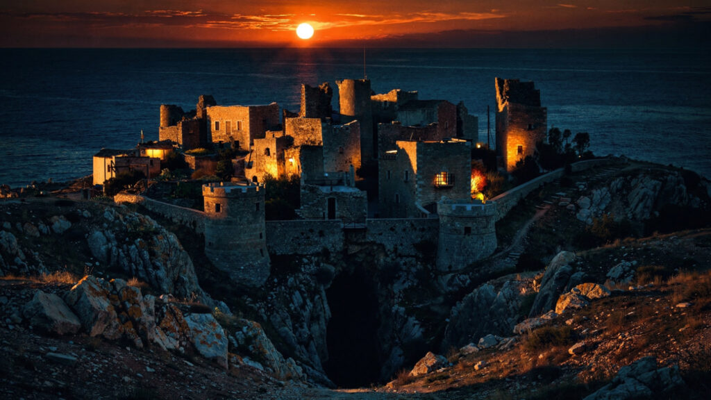
The Mani communities maintained, through the Ottoman period and into the modern era, the claim to descent from the ancient Spartans that the Byzantine and Frankish records describe as a genuine self‑identification rather than a later construction. The Maniots who refused to submit to the Ottoman administration and who preserved their culture in the inaccessibility of the cape were communities whose pride in this descent was the pride of people with something real to be proud of, a continuous inhabitation of the same landscape from the classical period that the Lacedaemonian inheritance had made the most celebrated warrior ethos in the ancient world.
Cape Tenaro, the southernmost point of mainland Greece, is reached from the village of Pyrgos Dirou south of Vathia by the road that follows the western coast of the Mani to the end of the cape. At this point, the ancient world located one of the principal entrances to the underworld. The cave above the water’s edge was the place where Heracles descended and brought Cerberus up from Hades, and where Orpheus made his descent to recover Eurydice. The cave is still there, reached on foot from the small chapel at the cape, and the quality of the landscape, the bare limestone above the deep blue water at the southernmost point of Europe’s largest peninsula, with the wind that the cape’s exposure produces in almost every season and the sound of the sea against the rocks at the base of the cliff, is the landscape that generated the ancient placement of the underworld’s entrance at this point.
Vathia is an hour’s drive south of Gytheio, the main town of the southern Mani, by the road that runs along the eastern coast of the cape past the villages of Kotronas and Lagia and the tower villages that line the mountain ridge above the coast. The village has a small number of restored tower-houses that the Greek Tourism Organization converted to accommodation in the 1970s in an early experiment in heritage tourism that produced results of uneven quality but that preserved the towers in habitable condition.
Arachova, Boeotia | The Village Between Dionysus and Apollo
Arachova sits on the southern slope of Mount Parnassus at 950 meters, directly above the Pleistos valley that leads down to Delphi, and its position in the landscape is the position of a community that inhabits the zone between the two sacred forces that Parnassus carried in the ancient imagination. The Apollonian oracle lay in the valley below, and the winter sanctuary of Dionysus lay in the Corycian Cave above.
The ancient world held that Apollo left Delphi for three months of the year, and that Dionysus presided over the sanctuary during this winter absence. These were the months when Apollo was believed to be in Hyperborea, the land beyond the north wind, and they were the months when the Thyiades, the female devotees of Dionysus from Athens, made their winter journey to Parnassus and performed their rites in the landscape above Delphi. The Corycian Cave, the large cavern on the high plateau of Parnassus that the Dionysian cult associated with these rites, is reached from Arachova by the road that climbs toward the ski area and from there by a path through the fir forest.
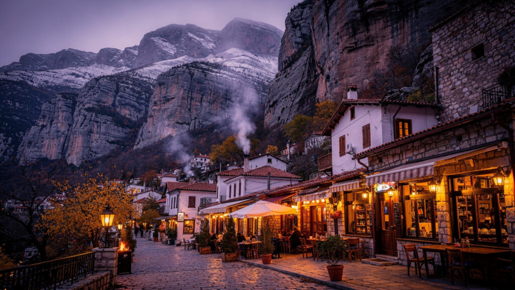
The Arachova of the contemporary visitor is the village that serves as the primary base for the Delphi visit and as the ski resort village for the Parnassus ski area that operates on the mountain above it from December through March. The combination of the archaeological tourism in the valley below and the ski tourism on the mountain above has made Arachova one of the most economically active small villages in central Greece, and the quality of the restaurants and the guesthouses in the village reflects this combination of cultural tourism and winter sports.
What the Arachova visit provides that the Delphi visit alone cannot is the quality of the landscape between the sanctuary and the mountain: the village’s position on the Parnassian slope gives it the views across the Pleistos valley to the mountains of the Peloponnese on the southern horizon that the sanctuary itself, enclosed in its ravine between the Phaedriades cliffs, does not have. The Arachova main street in the late afternoon, when the light is at the angle that catches the cliff faces of the Phaedriades above Delphi visible in the distance down the valley and the quality of the Boeotian autumn is present in the air, is the atmospheric encounter with the Parnassian landscape that the Delphi visit in the noon heat does not provide.
The village maintains the cheese and pasta tradition of the Parnassian pastoral communities: the local formaela cheese, a semi-hard sheep’s milk cheese with a flavor that the altitude and the grazing vegetation of the Parnassian slopes give to the milk, is the village’s food product whose quality is most directly and most immediately the product of the landscape. The tavernas of Arachova that serve the formaela grilled or baked in the wood oven, with the local pasta and the local wine, are the tavernas that serve the food of the place rather than the generic tourist menu.
Practical Considerations for the Five
The rental car is the essential vehicle for all five villages: none of them is accessible by a combination of public transport connections that would give the visitor the flexibility to arrive and depart on their own schedule rather than on the bus schedule that may or may not coincide with the village’s most productive visiting hours.
The spring months of April and May and the autumn months of September and October are the optimal visiting months for four of the five: Anogia and the Idaion Cave, Dimitsana and the Lousios gorge, Kalarrytes, and Vathia are all more rewarding in the wildflower spring or the harvest autumn than in the summer peak. Arachova has a winter character, when the ski area is operating and the village carries the quality of a mountain community in full winter operation, that is worth experiencing as the complement to the spring and autumn visit.
Accommodation in all five villages is the accommodation of the small family‑run guesthouse rather than the organized hotel. The quality of the local knowledge that the guesthouse owner carries about where to walk, what to eat, and what to look for in the surrounding landscape is the knowledge that makes the village stay different from the village day trip. Booking ahead in spring and autumn is necessary. The villages have limited accommodation capacity and the travelers who seek them out tend to do so in the same optimal seasons.
The distance between all five villages and the nearest large town is the distance that the village character requires: Anogia is an hour from Heraklion, Dimitsana is an hour from Tripoli, Kalarrytes is an hour and a half from Ioannina, Vathia is an hour from Gytheio, and Arachova is thirty minutes from Delphi. These are manageable distances that allow the visitor to use the village as the base and the nearby town as the practical supply point without requiring the village to provide everything that a larger settlement would.
At Olympus Estate, Wanderlust Greece guides you across the sacred and storied terrain of the Hellenic world, from the organized archaeological sites that the standard itinerary covers to the places where the myth is still in the landscape and the landscape still has people in it. The Idaion Cave above Anogia is the cave where Zeus was hidden. The Lousios gorge below Dimitsana is the river where the nymphs bathed him. The cape below Vathia is where Orpheus went down into the underworld. The cave above Arachova is where Dionysus spent Apollo’s winter absence. These are not metaphors. These are the places. Go to the places.