
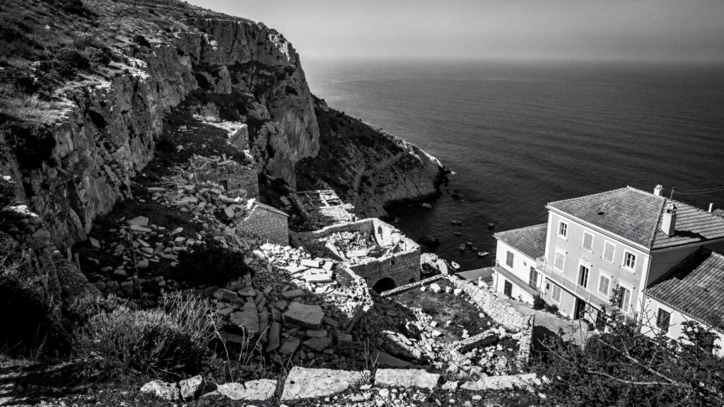
The earthquake of 1953 that destroyed Zakynthos also destroyed Kefalonia.
The same seismic event, the Ionian earthquake of August 12, 1953, at magnitude 7.2, struck the largest of the Ionian Islands with the same force it applied to its southern neighbor, collapsing approximately 80 percent of the buildings on the island and killing several hundred people. The destruction was comprehensive enough that Kefalonia’s built heritage, the Venetian-era architecture, the baroque churches, the neoclassical mansions accumulated across centuries of relatively prosperous island life, was almost entirely lost in a single morning.
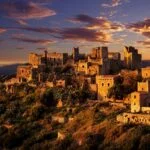
This fact is the context for everything the visitor encounters in Kefalonia’s villages and towns. The Fiskardo in the north, which is the most photographed village on the island and the one most cited for its preserved Venetian architecture, survived the earthquake because its position on the northern tip of the island placed it at sufficient distance from the epicenter. Everywhere else was rebuilt, and the rebuilt Kefalonia that the visitor encounters now is the product of decisions made in the 1950s and 1960s about what to reconstruct and how.
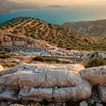
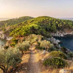
That the island is beautiful despite this, and beautiful in ways that have nothing to do with the built heritage that the earthquake removed, is the fact that the travel literature consistently underemphasizes in its enthusiasm for the scenery. The geological character of Kefalonia, the limestone mountains, the underground rivers, the collapsed cavern lakes, the white pebble beaches between the cliff faces, predates both the Venetian architecture and its destruction by hundreds of millions of years. The earthquake could not touch what the landscape is made of, and what the landscape is made of is the reason to go.
The Geological Character
Kefalonia is the largest of the Ionian Islands, covering approximately 302 square kilometers, and its dominant feature is the Mount Ainos massif in the center and east of the island, rising to 1628 meters. The mountain is the only place in the Ionian Islands where the Abies cephalonica species of silver fir grows, a tree species named for the island where it was first scientifically described, and the national park that protects the mountain’s upper slopes is one of the few in the Greek island world.
The island’s limestone geology produces the combination of surface and underground water management that makes Kefalonia geologically distinctive within the Ionian group. The famous phenomenon at Katavothres, on the coast near Argostoli, where seawater disappears into holes in the rock along the shoreline and moves underground through the island’s karstic geology to emerge at the Melissani lake on the eastern coast, was traced by scientific investigation in the 1960s using colored dye that appeared in the lake water fourteen days after being poured into the coastal sinks. The island processes the sea through its own interior.
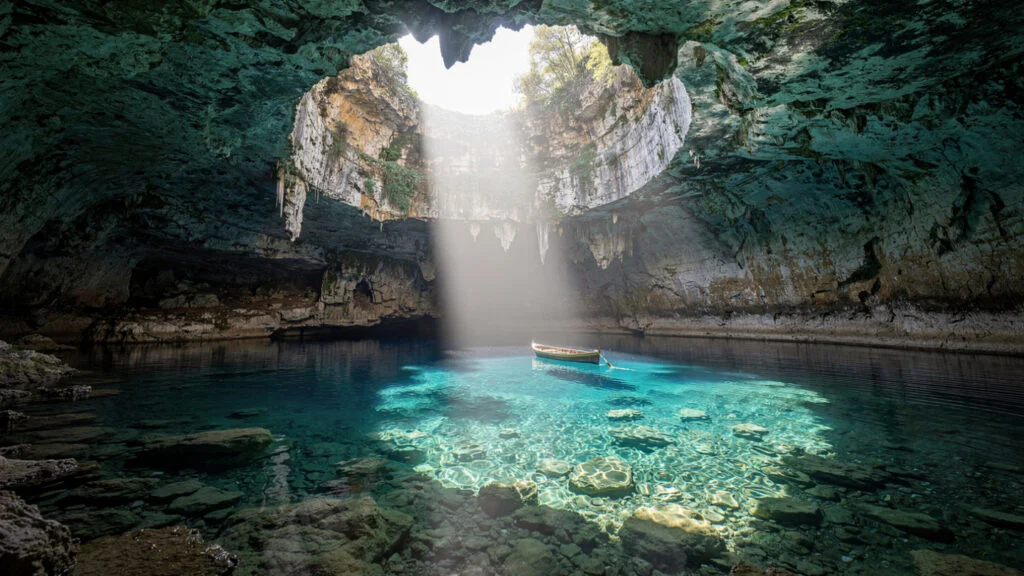
The Melissani Cave is the most visited expression of this geological character. A cavern whose ceiling collapsed at some point in the past, leaving a roughly circular opening through which sunlight reaches the lake that fills the cavern floor, the site is accessible by rowing boat from an entrance tunnel in the rock. When the sun is directly overhead around midday and at the optimal angle in the late morning, the light that enters through the ceiling opening creates the illumination of the water that every photograph of the cave attempts to reproduce: the lake surface in blues and greens and the refracted light creating moving patterns on the cave walls below the waterline. The effect is at its most pronounced between approximately 11 in the morning and 1 in the afternoon when the light enters the opening at the angle that maximizes its penetration into the water.
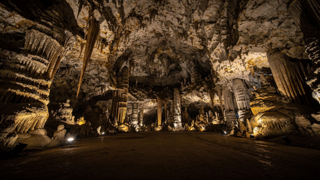
The Drogorati Cave, accessible from the main road between Sami and Argostoli, is a different geological formation: a deep cavern with a single accessible chamber of approximately 65 meters in diameter and 45 meters in height, filled with stalactite and stalagmite formations that have been growing for the approximately 100 million years the cave is estimated to have existed. The acoustics of the main chamber, produced by its dimensions and the rock composition of its walls, are sufficient that the cave hosts occasional classical concerts, an experience whose strangeness, orchestral music in a 100 million year old limestone cavern, is not reducible to either the music or the geology considered separately.
Myrtos and the Beach Geology
Myrtos Beach, on the northwestern coast of the island below the road from Argostoli to Fiskardo, is the most reproduced image in the Kefalonian travel canon and the beach that most directly expresses the geological character of the island in its most concentrated form.
The beach itself is white pebble, not sand: the pale limestone pebbles that the cliff erosion behind the beach produces over geological time, smooth and rounded by the water action that has been working on them since the cliff first began to erode. The cliffs that frame the cove on three sides rise to several hundred meters and are the same limestone formation that produces the underground river system, the caves, and the characteristic color of the island’s water. The mineral content of the limestone, combined with the depth profile of the cove and the angle at which sunlight enters it, produces the electric blue water that photographers travel significant distances to capture and that is not replicated with the same intensity elsewhere on the island.
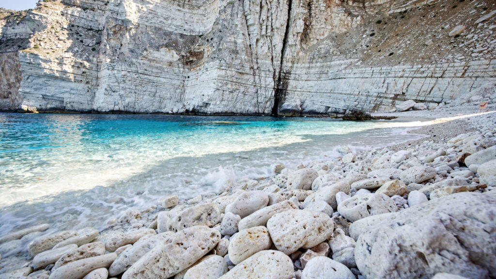
Access to Myrtos requires descending a road that switchbacks down the cliff face from a parking area at the top, a descent of approximately two kilometers. The beach has no permanent infrastructure. The combination of its accessibility by the cliff road and its inaccessibility to anyone who has not driven to the top creates the condition that a beach without a resort behind it produces: the view is available to anyone with a vehicle, the experience of the beach is available to anyone willing to make the descent and ascent on foot, and the absence of permanent facilities means that what the cove contains is the limestone, the pebbles, and the water.
The best time to experience Myrtos is in the morning before the midday heat makes the descent uncomfortable and the parking area at the cliff top fills to capacity. The afternoon visit is possible but involves the return ascent in the warmest part of the day, which the lack of shade on the cliff road makes more challenging than the numbers of afternoon visitors would suggest they have prepared for.
Fiskardo and What Survived
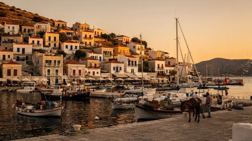
Fiskardo, the village at the northern tip of the island that the 1953 earthquake spared, is the only place in Kefalonia where the visitor encounters the pre-earthquake architectural character of the island in original rather than reconstructed form.
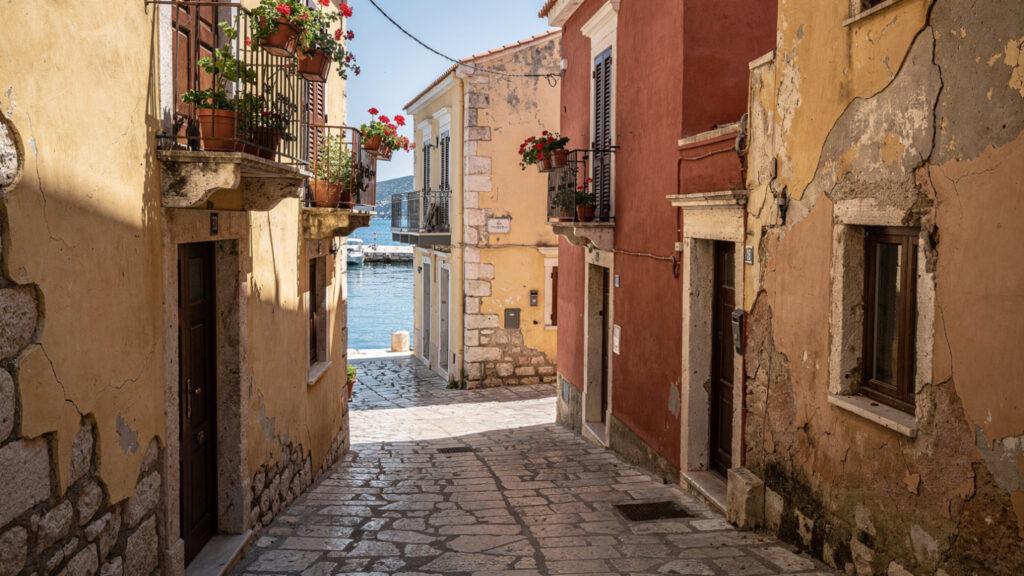
The buildings along the harbor front, the colorful facades, the Venetian-period structures that the village maintained because the earthquake did not reach them with the same force, are genuine rather than rebuilt. The harbor is small and sheltered, accessible to the sailing vessels that use it as an anchorage in the summer months, and the relationship between the buildings and the water is the relationship of a working harbor village that was designed for the boats rather than for the visitors who come to photograph them.
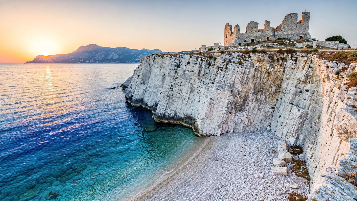
The road from Argostoli to Fiskardo, which follows the western coast of the island northward through villages and along cliff edges with views across the Ionian toward the Lefkada coast and the smaller islands between, is among the most rewarding driving routes in the Ionian Islands. It is not a fast road: the bends are frequent and the views are the kind that produce stopping. The village of Assos, on a narrow peninsula below the road about halfway up the western coast, holds the ruins of a Venetian castle on the hill above the village and the combination of a small harbor and a castle ruin that makes it the most photographed village in Kefalonia after Fiskardo itself.
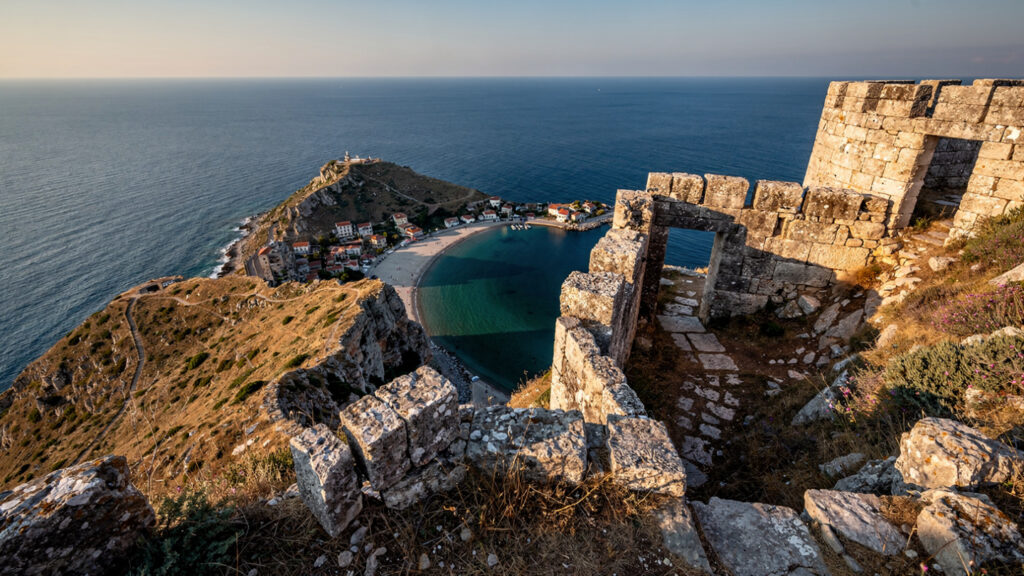
The castle at Assos, reached by a path from the village that takes approximately twenty minutes on foot, was built in the sixteenth century as the main Venetian defensive position in the northern part of the island. The earthquake of 1953 damaged the walls and the structures within the castle precinct, but the perimeter walls and the main gate have survived in sufficient condition that the site is walkable. The view from the castle walls across the peninsula below and the Ionian Sea in both directions is the reason to make the ascent independent of the castle’s historical significance.
Argostoli and the Turtles
Argostoli, rebuilt after 1953 on the plan of the earlier capital, is a working Greek town of approximately ten thousand people that functions as the administrative and commercial center of the island throughout the year rather than only during the tourist months.
The Lithostroto, the main pedestrian street of the town, holds the combination of shops, cafes, and the commercial life of a Greek island capital that is at its most animated on summer evenings when the passeggiata brings the local population into the streets in the way that the Mediterranean urban tradition maintains. The Archaeological Museum, rebuilt after 1953 and reorganized in the early twenty-first century, holds the material record of the island’s occupation from the Neolithic period through the Byzantine era, with the Mycenaean material being the most significant for understanding the island’s position in the prehistoric Aegean world.
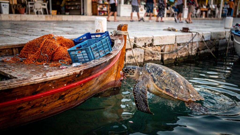
The loggerhead sea turtles at the Argostoli harbor are the most unexpected attraction of the island’s capital. The fishing boats that work the waterfront attract the turtles by the fish waste they produce, and the turtles that have learned this pattern can be observed from the quayside at close range during the summer months when the fishing boats are working. The turtles that appear in the capital harbor are adults, and their presence in the commercial harbor of a working Greek town, surfacing between the fishing boats and the tourist ferries, is the quality of an encounter with wildlife in an urban context that the organized turtle-watching tours at the nesting beaches of Laganas in Zakynthos cannot replicate.
The Robola Wine and the Kreatopita
The agricultural production of Kefalonia that the landscape sustains is most directly accessible through two products: the Robola wine and the kreatopita.
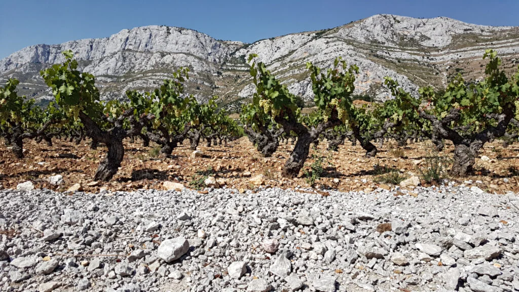
Robola is a white grape variety whose connection to Kefalonia is sufficiently old and sufficiently specific that it is one of the few Greek grape varieties with a Protected Designation of Origin that names the island in its classification. The wine it produces is dry, with the mineral character that the island’s limestone geology communicates to the vines grown in its soil, and with an acidity that makes it the correct accompaniment to the seafood-centered cuisine of the Ionian kitchen. The cooperative that manages most of the island’s Robola production operates a winery accessible from the main road through the Omala valley, where the grape is primarily grown, and tastings are available across the summer season.
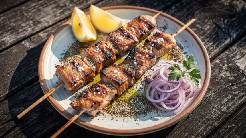
Kreatopita is the meat pie that Kefalonia produces in a form specific to the island: the filling of slow-cooked meat, typically lamb or veal, combined with rice and a blend of herbs and spices, enclosed in a pastry that the Kefalonians make thinner and crispier than the mainland Greek equivalent. The pie is made in households for the major feast days and in bakeries and tavernas as a year-round item, and the version that the family bakeries of the island’s villages produce is consistently closer to the original domestic preparation than the taverna version. The taste is the combination of the slow-cooked meat with the rice that has absorbed its juices and the pastry that has taken its color from the oven and its texture from the lard or olive oil that the baker uses.
Mandoles, the caramelized almonds that appear in the sweet shops of Argostoli and in the market stalls of the island’s festivals, are the confection most specifically associated with Kefalonia in the way that mandolato is associated with Zakynthos or kumquat sweets are associated with Corfu. The almonds are coated in caramelized sugar, sometimes spiced, and sold in paper cones by the vendors at village festivals and by the permanent shops in the capital. They are not an elaborate preparation. They are the combination of good local almonds and good caramelization, which requires attention rather than technique, and the version that the best producers make is the version that uses the island’s own almonds rather than imported ones.
Mount Ainos and the Forest
The national park on Mount Ainos is the only protected mountain environment on a Greek island in the Ionian group and the habitat of the Abies cephalonica fir that grows nowhere else in this form.
The black firs of Ainos, which appear dark rather than the grey-green of other fir species because of the density of their needle arrangement, cover the upper slopes of the mountain from approximately 800 meters to the summit at 1628 meters. The forest was more extensive before centuries of woodcutting and grazing reduced its coverage, and the national park status has allowed recovery of the tree population across the decades since the park was established.
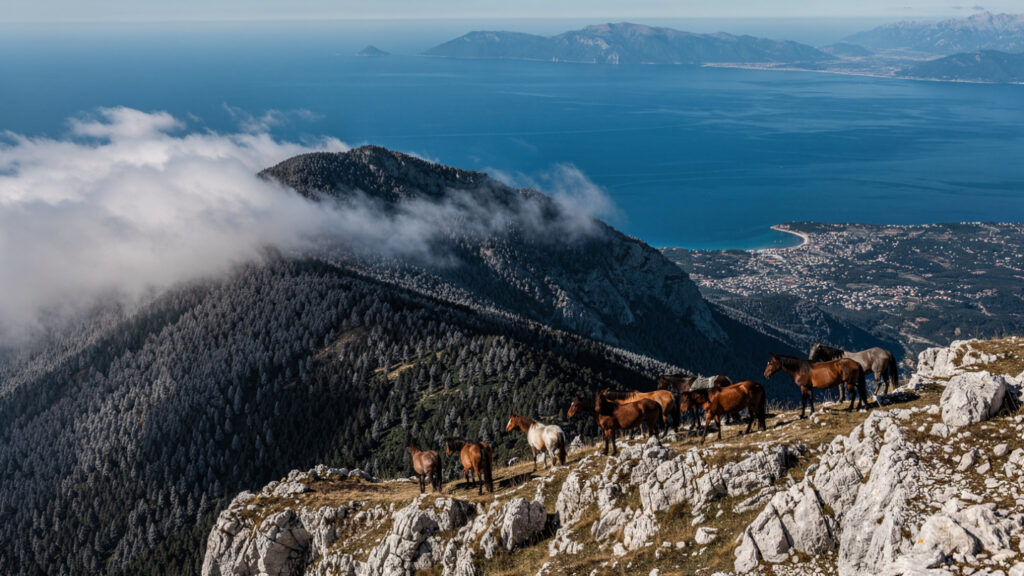
The ascent to the summit from the road that reaches the park’s lower boundary is possible in a full day and provides, on clear days, the view across the Ionian that the island’s elevation makes available: the neighboring islands of Zakynthos, Ithaca, and Lefkada visible in their positions in the sea, the Peloponnese coast of Greece to the east, and the quality of light over open water at altitude that the summit of the highest Ionian island provides.
The wild horses that have been present on Ainos since the Ottoman period, descendants of domestic animals that were released or escaped and have maintained their feral population in the mountain environment, are seen occasionally by hikers on the upper slopes. They are not reliably encountered, and their presence on any given ascent is a matter of timing and attention rather than a guaranteed attraction. When they are encountered, on the open ground above the tree line with the Ionian Sea visible behind them, the combination is the mountain’s best possible introduction.
Ithaca and the Mythology
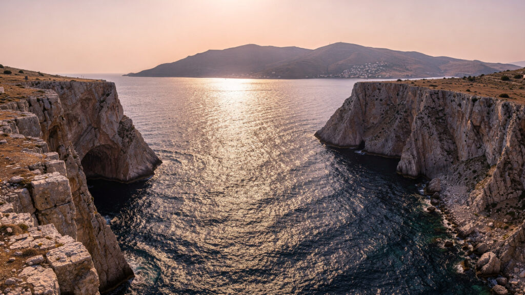
Kefalonia is separated from the island of Ithaca, which the Homeric tradition identified as the home of Odysseus, by a channel approximately two kilometers wide at its narrowest point. The relationship between the two islands in the mythological geography of the Odyssey has been the subject of scholarly and popular debate for as long as the text has been read.
The debate concerns whether the Ithaca of the Odyssey is the island now called Ithaca, which is smaller and positioned to the east of Kefalonia, or whether the Homeric descriptions of Odysseus’s kingdom more accurately describe Kefalonia itself or the combined territory of the two islands under a single administration. The arguments are textual, archaeological, and geographic, and they have not been resolved in the scholarly literature to the satisfaction of any particular position.
What the debate establishes for the practical traveler is that the two islands are in immediate proximity to each other, that ferries between them run regularly, and that a visit to Kefalonia is a short boat trip from the island that the tradition, disputed or not, has identified with the end of the greatest journey in Western literature. The combination of the two islands in a single trip, with Ithaca’s small harbors and the landscape that the Homeric imagination attached to Odysseus’s return, is the most complete version of the mythological geography that the Ionian offers.
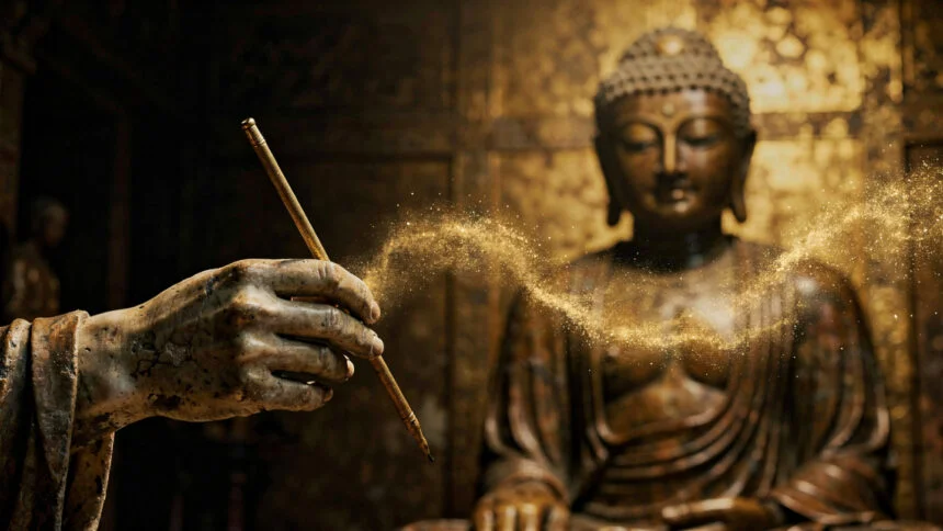
At Olympus Estate, Wanderlust Greece guides you across the sacred and storied terrain of the Hellenic world, from the underground river that moves through Kefalonia’s karstic interior to the Abies cephalonica firs that grow on Ainos and nowhere else on earth. The largest Ionian island keeps its secrets in the rock.


