
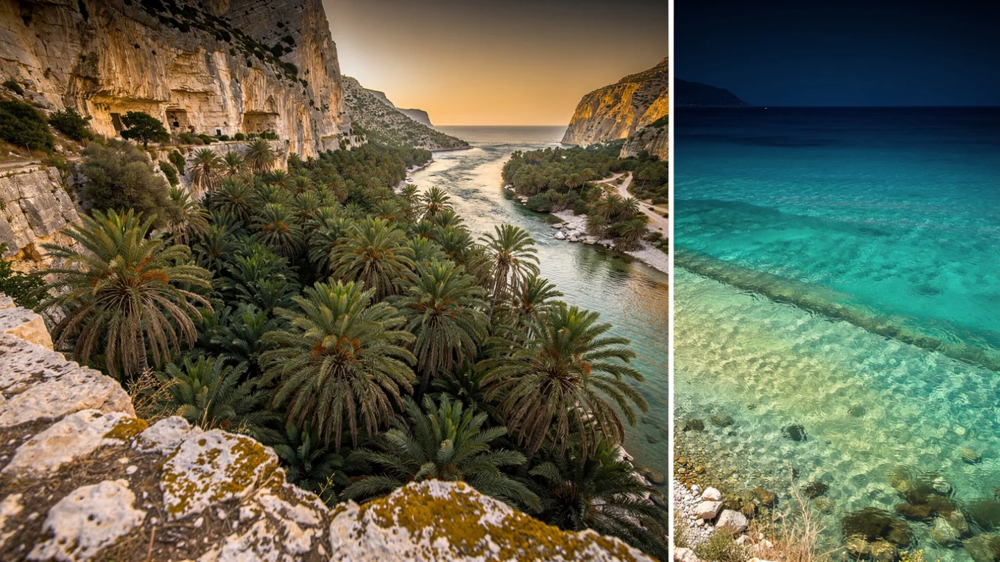
The palm forest at Preveli is the only naturally occurring palm forest in Europe.
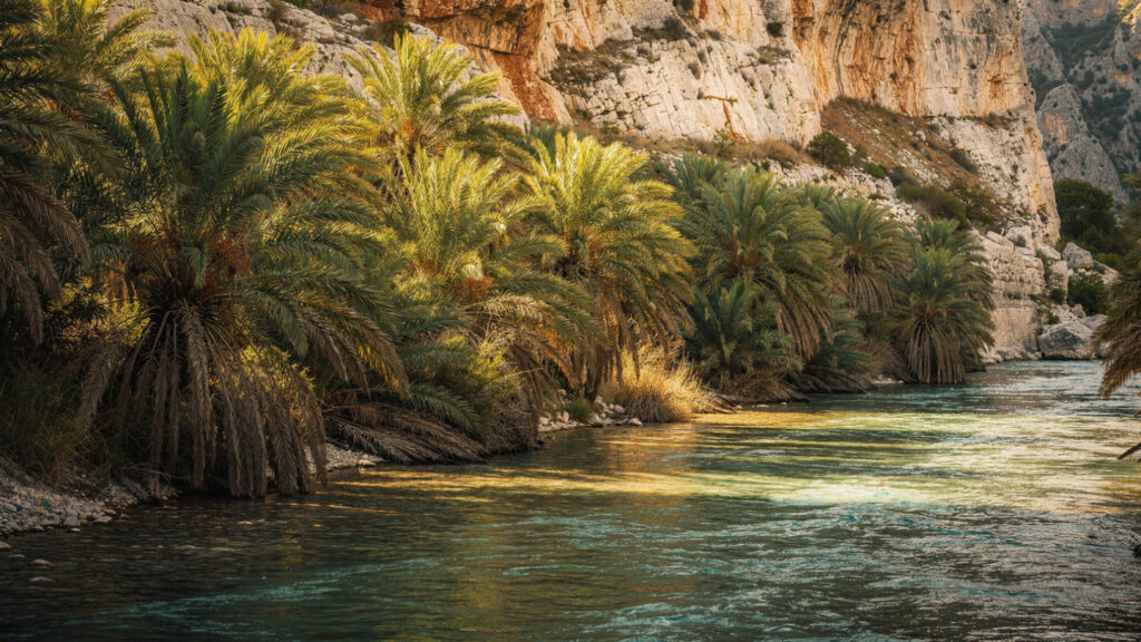
Not a planted grove, not an ornamental landscape, not an accidental seeding from cultivated stock: the Phoenix theophrasti palms that line the banks of the Kourtaliotis River in its final kilometers before it reaches the Libyan Sea are the survivors of a relic Mediterranean palm population that has persisted in this microclimate since the Tertiary period, when the palm’s range extended across the Mediterranean basin before the climate shifts of successive glaciations contracted it to a handful of surviving sites. The species is named after the ancient botanist Theophrastus, Aristotle’s successor as the head of the Lyceum and the author of the Historia Plantarum, who was the first systematic botanist of the ancient world and who documented the palm of the southern Cretan coast in his text. The palm that Theophrastus described is the palm that still stands at Preveli, in the gorge and delta microclimate that has kept the species alive when the surrounding Mediterranean landscape lost its palm populations to the long cooling and drying.
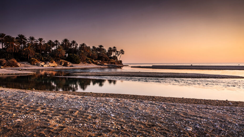
The landscape that results from this botanical survival is the landscape that defies the visual expectation that the Aegean word Greece tends to generate in the imagination: the river flowing through the gorge, the palm canopy extending over the water, the quality of the light through the palm fronds, the brackish mixing zone where the Kourtaliotis meets the Libyan Sea, and the sound of the river in the gorge above the beach before it opens into the delta plain. It looks, at first glance, like a landscape that belongs somewhere else. It belongs here. It has always belonged here. It is the landscape that the Mediterranean had before the climate changed, preserved in the microclimate of the gorge where the water and the limestone and the southern exposure have maintained the conditions that the palm requires.
The Kourtaliotiko Gorge
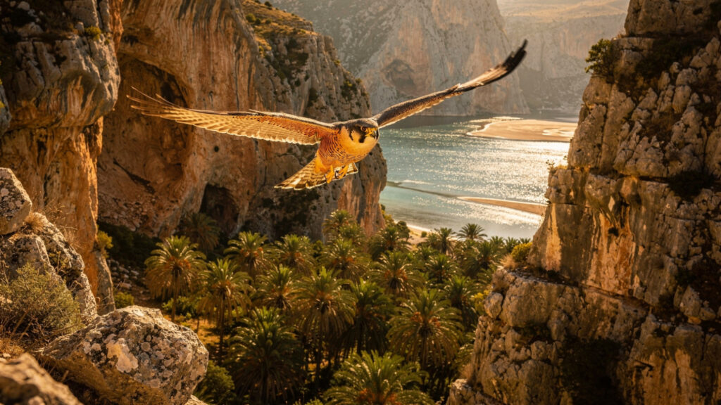
The Kourtaliotiko Gorge, which the Kourtaliotis River has been cutting through the limestone of the Rethymno plateau for geological time, reaches its most dramatic section in the twelve kilometers between the village of Koxare at the gorge’s head and the coastal plain above Preveli. The gorge walls in the deepest sections rise to approximately 600 meters above the river, and the acoustic character of the narrow passage gives the gorge its name: kourtala is the sound that the wind makes as it funnels through the confined space, a percussive quality that the limestone walls amplify and reflect in the way that the gorge’s geometry determines.
The gorge is the habitat for a population of Eleonora’s falcons, the long-winged migratory falcon that nests in the cliff faces of the Cretan gorges and the Aegean island cliffs and that feeds on the migrant songbirds that pass through the gorge in August and September on their southward passage to Africa. The Eleonora’s falcon breeds later in the season than any other European raptor specifically in order to time its breeding cycle to the autumn migration corridor: the falcon’s chicks are in the nest at the exact moment when the migrant prey is available in the highest density. The ecological adaptation that produces this timing is one of the more elegant examples of evolutionary precision in the European rapture fauna, and the Kourtaliotiko Gorge is among the most accessible Cretan locations in which to observe the falcons during the autumn hunting season.
The falcons share this terrain with Crete\’s other defining wild resident, the Kri-Kri goat, whose own cliff-face agility belongs to the same ancient, undomesticated character of the island’s mountain gorges.
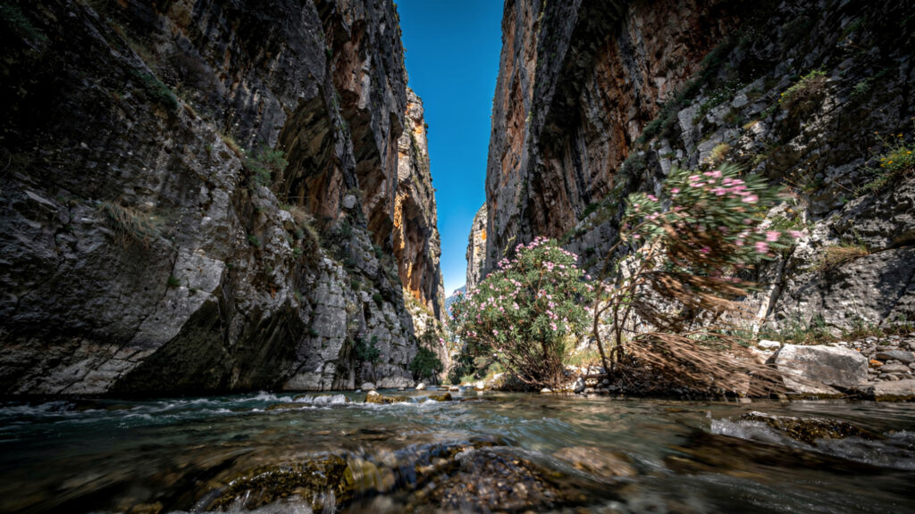
The botanical diversity of the gorge walls, the combination of the endemic Cretan herbs and the rock plants that the limestone face supports and the palm forest below, gives the gorge its character as a site of concentrated ecological interest rather than simply dramatic scenery. The wild gladiolus and the Cretan tulip and the geophytes of the southern Cretan limestone are at their most accessible in the gorge’s lower section in April and May, before the summer heat desiccates the vegetation to the dry grey-brown that the summer Cretan landscape presents.
The marked path through the gorge from the Koxare road to the Preveli Monastery above the beach takes approximately three hours at a moderate pace, descending from the plateau level through the gorge’s most confined section to the coastal plain. The path is not technically demanding but requires appropriate footwear and water: the gorge’s microclimate, sheltered from the plateau wind and channeling the sun’s heat from the limestone walls, produces temperatures significantly higher than the surrounding landscape in the summer months.
The Monastery and the War
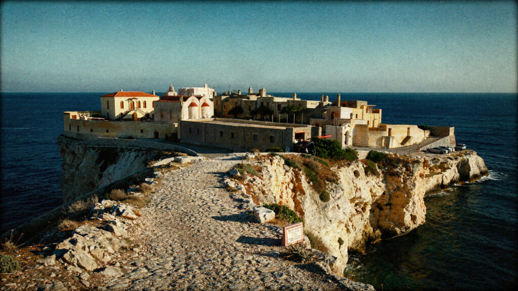
The Monastery of Preveli, the Moni Preveli that occupies the headland above the beach on the eastern side of the river mouth, is the institution whose history gives the landscape its most dramatic human dimension and connects the Cretan landscape’s ancient character to its modern one in the form of the resistance tradition that defines Cretan identity as completely as the Minoan archaeology or the Byzantine churches.
In May and June of 1941, following the German airborne invasion that defeated the Allied forces defending Crete in the Battle of Crete, the abbot of the Monastery of Preveli, Agathangelos Lagouvardos, organized the shelter and the subsequent evacuation of hundreds of Allied soldiers who had been left behind when the main evacuation from the northern coast was completed. The soldiers, primarily Australian and New Zealand troops from the units that had fought in the Battle of Heraklion and the Battle of Rethymno, made their way through the Cretan mountains and the southern coast to the monastery, where the monks provided food, shelter, and medical assistance while the abbot coordinated with the Allied naval command to arrange the submarine evacuations that took the soldiers off the Preveli beach to the vessels waiting in the Libyan Sea.
The geography of Preveli, the isolated beach accessible from the sea but difficult to approach overland without local knowledge, made it the appropriate evacuation point: the German forces could not easily intercept the beach from the north without the knowledge of the gorge approach that the local Cretan population had and that they did not share with the occupying force. The palm forest and the river gorge that the tourist literature describes as the beach’s tropical beauty were the features of the landscape that made the beach militarily useful as an evacuation point: the cover of the gorge, the difficulty of the approach, and the boat access from the Libyan Sea were the properties that the wartime use required.
The monastery was subsequently occupied by the German forces and the abbot Lagouvardos was arrested and transported to a prison camp on the mainland. He survived and returned to Crete after the liberation. The connection between the monastery’s wartime role and its ancient role as the guardian of the southern Cretan coast’s spiritual life is the connection that gives Preveli its layered character as a site where the ancient religious function and the modern historical event occupy the same space in the landscape.
A memorial plaque on the monastery’s wall commemorates the evacuation, and the monastery’s small museum holds the documentation of the wartime period alongside the ecclesiastical objects of the earlier centuries. The monastery is open to visitors with the standard Greek monastery dress requirements: covered shoulders and knees, available at the entrance for visitors who arrive without appropriate clothing.
The Beach and the River Delta
Preveli Beach occupies the zone where the Kourtaliotis River meets the Libyan Sea, and the character of the beach reflects the dynamics of the river-sea interface that creates it: the fresh water from the gorge meets the salt water of the Libyan Sea in the brackish mixing zone of the delta, and the palm forest extends from the river banks to the beach’s edge in the configuration that the delta’s sediment deposition has maintained.
The beach itself is a combination of sand and pebble in the mixture that the river’s sediment load and the sea’s sorting processes produce: the finer material deposited by the river’s slower flow in the delta zone and the coarser material sorted by the wave action at the shoreline combine to give the beach its textural character. The water in the river-sea mixing zone is warm in the summer months from the river’s sun-heated surface flow and cooler from the river’s deeper spring-fed flow and from the Libyan Sea’s depth, producing the temperature layering that the swimmer in the delta zone experiences as alternating warm and cool pockets.
The Libyan Sea visible from the beach is the open Mediterranean stretching south toward Libya and Egypt with no intervening land: Preveli is on the southernmost coast of the southernmost large island in the Aegean world, and the quality of the view from the beach, the open water extending to the horizon without any islands or headlands interrupting the view, is the quality of a genuinely oceanic horizon rather than the enclosed inter-island view that most Aegean beaches present. The light quality that this open southern exposure produces, the intensity of the southern Cretan sun without the atmospheric filtering that the northern Aegean’s more sheltered geography provides, is part of what gives Preveli its visual character.
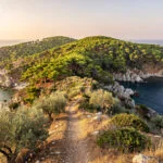
The beach is accessible from three directions: the gorge path from the north that the article’s practical section describes, the monastery road from the east that ends at the clifftop parking area above the beach with the steep descent to the shore, and the boat service from the harbors of Plakias and Agia Galini during the summer season. The boat approach from the west is the approach that most completely reveals the beach’s setting from the sea perspective: the palm forest visible above the beach before the beach itself comes into view, the monastery on the headland to the east, and the gorge opening visible in the cliff face to the north.
The Natura 2000 Designation and Its Consequences
The Preveli delta and the Kourtaliotiko Gorge are included in the Natura 2000 network of European protected habitats, the designation that the European Commission applies to the most significant natural habitats in the member states and that carries restrictions on development and land use within the designated area.
The practical consequence of the Natura 2000 designation for the visitor is the consequence that the protected status of the habitat prevents: no permanent beach infrastructure, no beach bars, no organized beach services, no amplified music, no development of the kind that the commercially organized Greek island beaches of the main tourist circuit provide. Preveli is the beach in the condition that the protected natural habitat requires rather than the condition that the organized beach tourism infrastructure would produce if the protection were absent.
The Phoenix theophrasti population’s inclusion in the protected habitat designation is the inclusion that reflects the species’ conservation status: Phoenix theophrasti is endemic to the eastern Mediterranean, with populations primarily in Crete and the Turkish coast, and its population at Preveli is the largest and most ecologically intact remaining population of the species. The combination of the river flow, the gorge microclimate, and the delta’s sediment dynamics that maintains the Preveli palm population is the combination that the conservation designation is protecting: not simply the existing trees but the ecological processes that allow the population to reproduce and maintain itself.
The Eleonora’s falcon population in the gorge, the endemic Cretan plants of the gorge walls, and the brackish water community of the delta’s mixing zone are the other components of the ecological system that the designation protects, each representing an element of the southern Cretan limestone gorge and coastal delta ecosystem that the Preveli site contains in its most complete available form.
When to Go and How to Arrive
The optimal visiting months for Preveli are May, June, September, and October. May and early June offer the botanical peak of the gorge plants and the most comfortable gorge walking temperatures before the summer heat makes the south-facing limestone walls a heat trap in the middle hours. September and October offer the Eleonora’s falcon hunting activity at its peak as the autumn migration corridor opens, the sea temperature still warm from the summer’s heating, and the reduced visitor density that the shoulder season produces.
July and August bring the maximum visitor density and the maximum heat: the Preveli beach in August at midday is the beach with the maximum competition for shade and the maximum temperature in the gorge path. The boat service from Plakias reduces the gorge walk requirement for the visitor who arrives in August but accepts a different quality of experience: the boat arrival gives the beach directly without the gorge approach that is the most complete engagement with the landscape.
The gorge walk approach is the approach that gives the visit its fullest character: the transition from the plateau landscape at the gorge head, through the confined passage of the gorge’s deepest section, to the opening of the delta and the beach at the gorge’s mouth, is the transition that makes the beach a destination earned rather than a destination arrived at. The palm forest encountered after three hours in the gorge is the palm forest received with the quality of attention that the difficulty of the approach has prepared.
The monastery visit, which the headland road makes accessible without the gorge walk, is the complement to the beach visit rather than its substitute: the monastery above the beach that sheltered the Allied soldiers in 1941, the memorial plaque on the wall, the view from the headland across the beach and the palm forest to the Libyan Sea, and the continuity between the ancient monastic foundation and the modern wartime history are the dimensions of Preveli that the beach visit alone does not reach.
Go to the gorge. Walk through it. Arrive at the beach having done the approach. Then climb to the monastery and stand on the headland and look at where the evacuation boats came from in the summer of 1941 and where the submarines waited in the Libyan Sea beyond the beach. The landscape contains all of this simultaneously. It is doing no work to show it to you. It is simply there, in the form that the geology and the ecology and the history have given it, waiting for the visitor who arrives prepared to receive it.
At Olympus Estate, Wanderlust Greece guides you across the sacred and storied terrain of the Hellenic world. The Phoenix theophrasti palm at Preveli is a relic of the Tertiary Mediterranean, surviving in the gorge microclimate since before the Aegean had its present form. The abbot Lagouvardos sheltered Allied soldiers in the monastery above the beach and coordinated their evacuation to the submarines in the Libyan Sea in the summer of 1941. The German forces subsequently arrested him. He survived and returned. The monastery is still there. The palm forest is still there. The Libyan Sea is still there, open to the horizon with no land between Preveli and Africa. Walk through the gorge. Arrive at the beach. Go up to the monastery. The landscape explains itself.