The wilderness of Greece was not preserved by planning.
It was preserved by accident, by the combination of three overlapping historical processes that each independently protected different parts of the Greek landscape from the clearance and development that destroyed the equivalent landscapes across the rest of the Mediterranean. The ancient sacred grove tradition that made certain trees and certain forests theologically untouchable. The Ottoman administrative failure in the mountains that made certain landscapes practically unreachable and therefore practically uncleared. And the twentieth-century conservation framework that arrived in time to protect what the first two processes had left intact.
None of these processes was designed to preserve wilderness. The temenos, the sacred grove around the ancient Greek sanctuary, was preserved because it was sacred to a deity whose anger at the desecration of the grove was a genuinely feared consequence rather than a metaphorical one: the ancient woodcutter who felled a tree in the temenos was not making an environmental decision, he was risking divine retribution of the kind that the grove’s patron deity was known to deploy. The Ottoman administrative failure in the Epirus mountains and the Rhodope forest and the Evros gorges was not a conservation policy: it was the consequence of terrain that the administrative system could not reach, which left the forests standing not from protection but from neglect. The national park designations and the Natura 2000 network of the twentieth and twenty-first centuries are the first deliberately planned conservation framework in the Greek landscape’s history.
But the three processes together produced a result: the Greek wilderness that survives today is among the most ecologically significant in Europe, and the locations where it survives most completely are the locations where all three processes overlapped in the same landscape at the same time.
The Ancient Sacred Grove and Its Ecological Legacy
The relationship between the ancient Greek sacred grove tradition and the contemporary ecological significance of Greek landscapes is not metaphorical. It is causal.
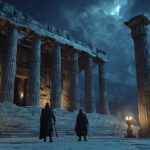
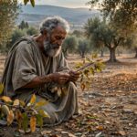
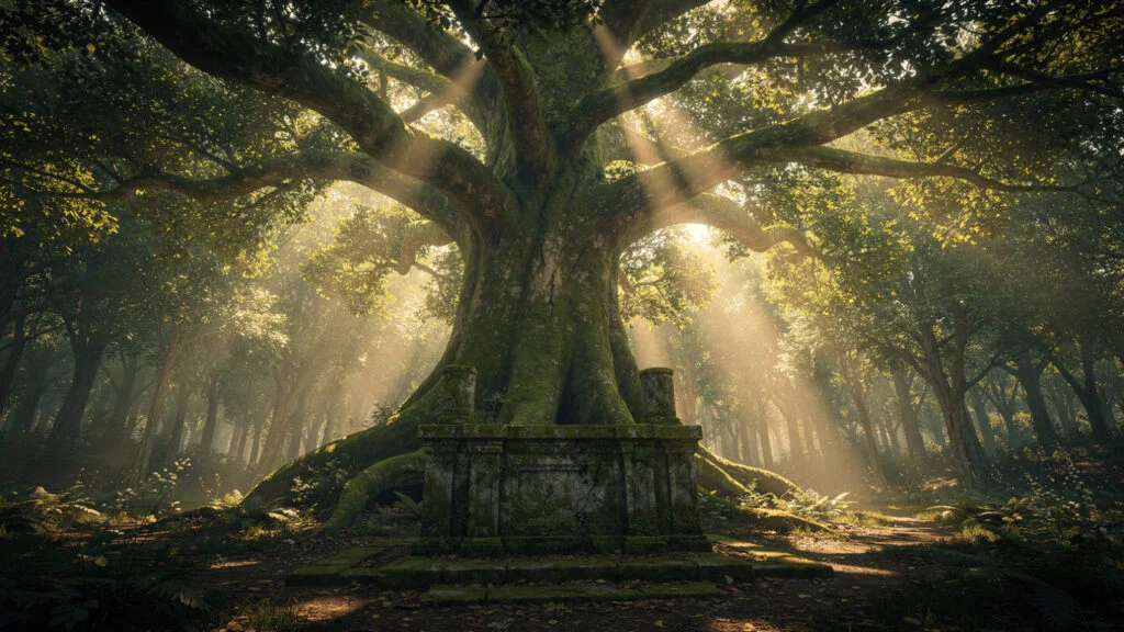
The temenos, the sacred precinct whose boundary defined the divine territory around the ancient sanctuary, was the sacred grove in its most directly institutionalized form: the cut-off space, as the etymology from temnein makes clear, whose botanical character was the woodland that had been present at the site when the divine presence was first recognized and whose preservation was understood as the condition of the divine presence’s continuation. The grove was not decorative. It was the residence of the deity, and the deity’s continued willingness to inhabit the residence depended on the community’s willingness to maintain the residence in the condition the deity required.
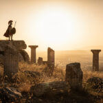
The sacred trees article in this collection develops this theology at depth: the Dodona oak as the literal voice of Zeus, Athena’s olive whose miraculous resprouting after the Persian burning Herodotus records, the laurel’s connection to Apollo, the Gortynian evergreen plane tree of the Europa myth. The ecological consequence, across the centuries this practice operated, was the protection of woodland sites the divine association made theologically dangerous to clear. The grove around Delphi, the woodland of the Altis at Olympia, the sacred forests of the major sanctuaries across the Greek world.
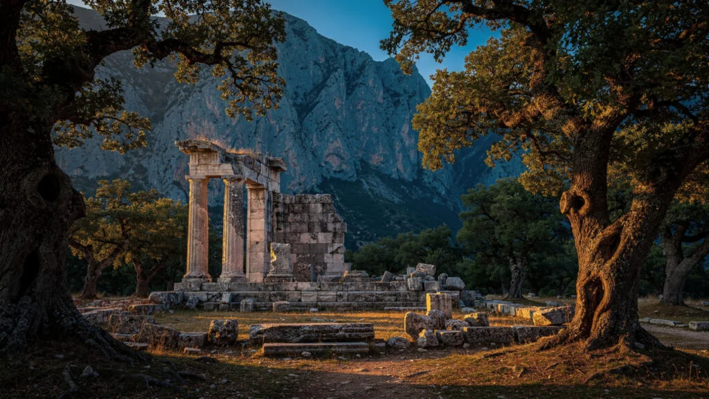
The sites where ancient Greek sanctuaries were located tend to be sites with real environmental character: springs, groves, dramatic natural features, the combination of the accessible and the slightly apart from the ordinary human world that ancient sacred geography consistently preferred. Selecting these sites for sacred status meant selecting a subset of the Greek landscape for preservation across the entire span of classical religious practice, and the effect of that preservation shows most clearly in the surviving ancient woodland of the landscapes where sacred groves were once most numerous.
The Ottoman Inaccessibility and the Forest It Preserved
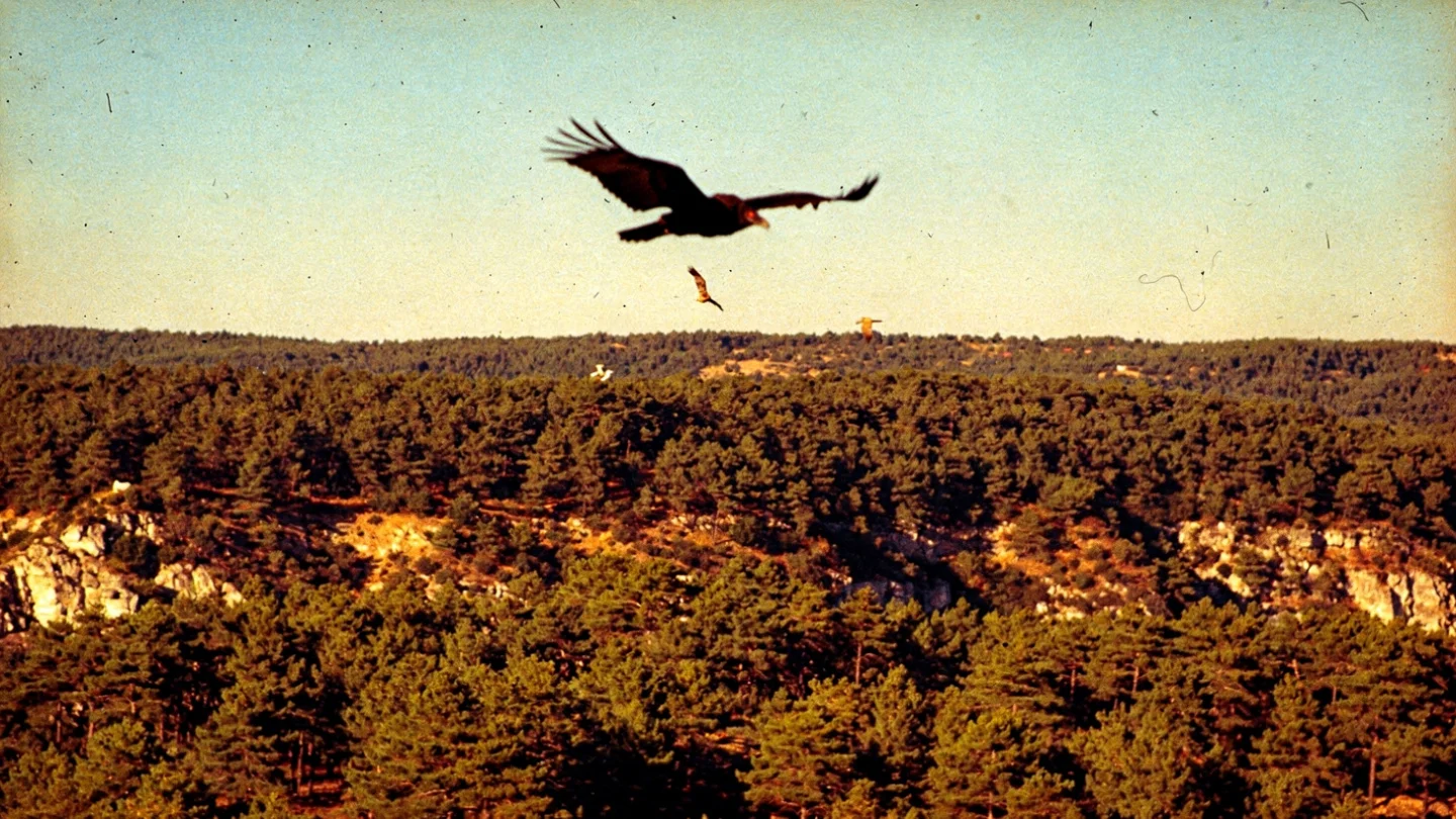
The Evros region of northeastern Greece contains Europe’s most significant remaining raptor sanctuary: the Dadia-Lefkimi-Soufli Forest National Park, whose dense pine and oak forests support all four European vulture species simultaneously, a combination that exists nowhere else on the continent.
The Dadia forest survived because the Ottoman imperial hunting reserve that covered it from the sixteenth century onward maintained the legal protection that the Ottoman administration gave to the imperial hunting grounds: the Padisah avlağı, the sultan’s hunting reserve, was protected from clearance and settlement by the authority of the imperial court, and the forest that survived as the sultan’s hunting ground in the sixteenth century is the forest that became the European raptor sanctuary in the twentieth.
The mechanism is the mechanism of the overlapping protection: the Ottoman imperial authority protecting the forest for hunting preserved the same ecological conditions that the twentieth-century conservation framework subsequently recognized as the basis for the raptor sanctuary designation. The Black Vultures that nest in the Dadia forest’s oldest trees, the Griffon Vultures that soar in the thermals above the Evros gorges, the Lammergeier or Bearded Vulture whose ecological role as the bone-breaker at the end of the raptor feeding hierarchy makes it the most specialized of the four species, are the birds that the Ottoman sultan’s forest protection inadvertently preserved for the European conservation tradition to protect deliberately.
The forest’s position at the edge of the Evros River, the river that forms the border between Greece and Turkey and whose gorge system provided the natural boundary that made the Ottoman administrative distinction between the protected hunting reserve and the settled agricultural landscape most easily maintained, is the geographical feature whose combination with the imperial protection produced the outcome: the forest that survives today.
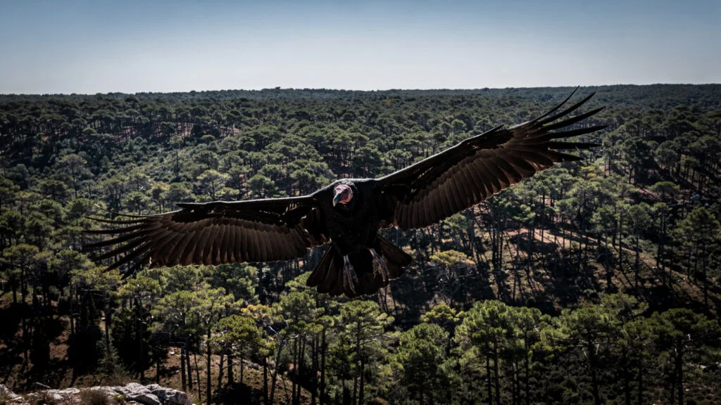
The Black Vulture in particular, whose European population crashed through the twentieth century as the livestock farming practices that provided the vulture’s food supply were industrialized and as the deliberate poisoning campaigns against wolves and foxes killed vultures at the baited carcasses, maintains one of its most significant remaining European nesting populations in the Dadia forest. The recovery of the Dadia population across the last three decades of conservation management is one of European conservation’s genuine success stories, and it began with the forest that the Ottoman sultan’s hunting reserve had preserved.
The Prespa Lakes and the Border That Protected Them
The Prespa basin in northwestern Greece, the shared wetland whose two lakes, the Great Prespa and the Little Prespa, are divided between Greece, Albania, and North Macedonia, survived as the most intact large wetland ecosystem in the Balkans for a reason that has nothing to do with conservation planning and everything to do with the geopolitical character of the Cold War border.
The Prespa basin occupied the triple border zone where the three countries met during the period when all three maintained heavily militarized frontier zones whose character made civilian development in the immediate border area strategically undesirable. The Greek side of the border maintained the restrictions on settlement and economic activity that the military frontier zone imposed, and those restrictions preserved the Prespa wetland from the drainage and agricultural conversion that destroyed comparable wetland systems across the European continent in the postwar decades.
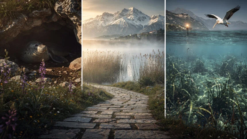
The Dalmatian Pelican population that now nests on the islands of the Great Prespa is the most directly visible consequence of this accidental preservation: the Dalmatian Pelican, which by the 1980s had been reduced to approximately a thousand individuals across its entire European range by hunting, habitat destruction, and persecution by fishermen who regarded it as competition, maintained one of its most significant nesting populations in the Prespa basin precisely because the military frontier zone restrictions had kept the most disruptive forms of human activity away from the nesting sites.
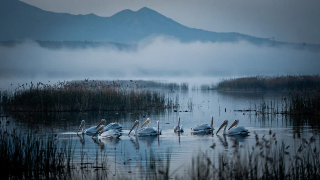
The Prespa Park Agreement of 2000, in which Greece, Albania, and North Macedonia established a shared transboundary conservation framework for the Prespa basin, is the example of the twentieth-century conservation planning arriving in time to protect what the accidental preservation had left intact. The three countries that had maintained the military frontier zone that accidentally preserved the wetland subsequently established the deliberate conservation framework that protects it. The geopolitical accident became the conservation opportunity.
The Byzantine monastery of Agios Achilleios on the island of the same name in the Little Prespa lake is the historical dimension that gives the Prespa landscape its characteristic Olympus Estate depth: the ruins of the basilica that the Bulgarian Tsar Samuel built in the late tenth century CE on the island where he had transferred the relics of Saint Achilleios from Larissa are the ruins of the most significant medieval monument in the Prespa basin, and the combination of the Byzantine ruins on the lake island, the Dalmatian Pelican nesting colonies on the adjacent islands, and the mountain landscape of the Prespa basin’s rim that the lake reflects, gives the site the quality of the landscape that carries multiple centuries of human and natural history in the same visual field.
The Alonissos Marine Park and the Monk Seal
The Mediterranean monk seal is the most endangered marine mammal in Europe. The current population is estimated at approximately 800 individuals across the entire Mediterranean basin and the eastern Atlantic coast of North Africa, making it rarer than many of the large mammals that the conservation tradition more consistently publicizes as endangered.
The National Marine Park of Alonissos and Northern Sporades, established in 1992 as the first marine park in Greece and one of the first in the Mediterranean, was established specifically because the northern Sporades islands and the sea around them supported one of the largest remaining monk seal populations in the Mediterranean: approximately 50 to 60 individuals in the core population area, representing perhaps six to eight percent of the entire global population in a single protected area.
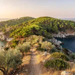
The monk seal’s biology explains the geography of the park’s protection: the monk seal requires the sea caves of the island coastlines for pupping, the enclosed rocky chambers at sea level where the females can give birth and nurse their pups in the conditions of limited human disturbance that the pups require to survive the first weeks of their lives. The northern Sporades islands, whose combination of the deeply indented limestone coastlines and the relative inaccessibility that the distance from the major tourist routes of the Cyclades and the Dodecanese provided, supported more of these cave habitats with less human disturbance than anywhere else in the northern Aegean.
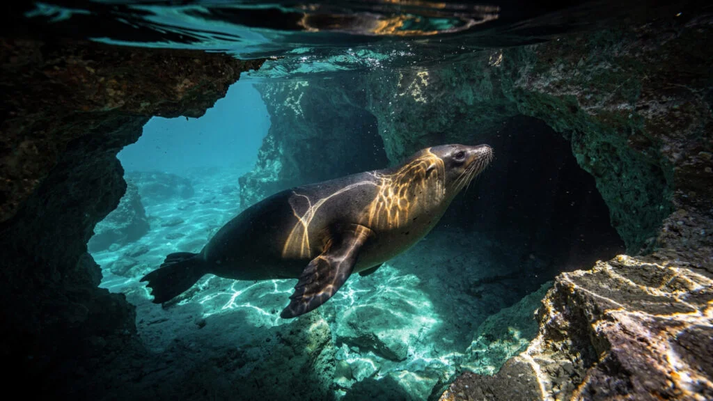
The human pressure that had reduced the monk seal population most directly was the same pressure that reduced it everywhere else in the Mediterranean: fishing. The monk seal competed with fishermen for the same fish stocks, and the fishermen’s response across the twentieth century was the same response as across the Mediterranean: deliberate killing of the seals at the nets where they were most visible and most easily killed. The Alonissos marine park’s establishment imposed the protection that reduced this direct killing pressure, and the population has shown the slow recovery that the species’ reproductive biology, which produces one pup per year per female at most, makes the maximum achievable rate.
The visitor to the marine park encounters the monk seal at the level of the occasional glimpse rather than the reliable wildlife tourism experience: the animal’s fundamental shyness and the requirements of the cave habitat mean that the systematic observation that the birdwatching tradition enables with vultures and pelicans is not available with the monk seal. The encounter, if it comes, comes as the surfacing animal in the cove where the boat has stopped for the swimming break, and its brevity and its unexpectedness are appropriate to the animal whose survival has depended on avoiding exactly the consistent human attention that the systematic wildlife tourism experience requires.
The Samaria Gorge and What It Actually Is
The Samaria Gorge in the White Mountains of Crete is the most visited wild nature site in Greece, with approximately 100,000 visitors per year walking the sixteen-kilometer route from the Omalos plateau to the Libyan Sea coast at Agia Roumeli. This popularity creates the tension between the wilderness experience that the gorge’s ecological and geological character provides and the organized mass tourism infrastructure whose visible presence manages and distributes the visitor load through the gorge’s most confined sections.
The gorge’s ecological significance is the significance of the Cretan endemic species it supports: the kri-kri, the Cretan wild goat whose taxonomic status as either a separate species Capra aegagrus creticus or a feral population of the bezoar goat is still debated in the literature, maintains its most significant remaining wild population in the White Mountains above the Samaria Gorge, in the high mountain terrain above the gorge that the national park protects from the hunting pressure that extirpated the animal from the lower elevations. The vulture population of the White Mountains, the Griffon Vulture colonies that nest in the limestone cliffs above the gorge, and the endemic plant populations of the Cretan mountain flora are the other ecological dimensions of the site whose significance the visitor on the gorge trail is adjacent to but not necessarily directly encountering.
The gorge’s geological significance is the significance of the limestone karst process that produced it: the Tarraios stream has been cutting through the White Mountains limestone for the geological time that produced the depth and narrowness of the Iron Gates passage, where the gorge walls rise approximately 300 meters above a passage three to four meters wide, and the acoustic character of the Iron Gates, the way the sound of the water and the visitor’s own movement is reflected and amplified by the vertical limestone walls, is the character of the geological process made directly perceptible to the human body moving through it.
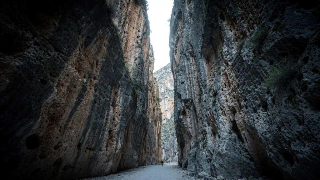
The tension between the gorge’s ecological significance and its tourist infrastructure is the tension that the Samaria Gorge National Park’s management has not fully resolved and that no management approach for a site of this combination of ecological value and tourist demand has fully resolved anywhere in the world: the wilderness that the visitor comes to experience is the wilderness whose character is partly defined by the absence of the management infrastructure that the visitor’s presence requires. The gorge is most itself at the hours when the visitor load is lowest, which is the reason that the early start the practical guides consistently recommend is the recommendation that transforms a mass tourism experience into something closer to the genuine wilderness encounter the site is capable of providing.
What the Surviving Wilderness Reveals
The locations of the Greek wilderness that survives most completely, the Dadia forest, the Prespa basin, the northern Sporades, the White Mountains of Crete, the Vikos Gorge whose Epirus article develops at length, are not random. They are the locations where the combination of the ancient protection, the Ottoman inaccessibility, and the twentieth-century conservation framework overlapped most effectively.
The Dadia forest survived as the Ottoman hunting reserve and then as the twentieth-century raptor sanctuary. The Prespa basin survived as the Cold War military frontier zone and then as the transboundary conservation agreement. The northern Sporades survived as the relatively inaccessible island archipelago and then as the marine park. The White Mountains survived as the mountain terrain that the Bronze Age Minoan civilization had already identified as the domain of the Cretan wild goat and that the national park designation subsequently protected.
In each case, the wilderness that the visitor encounters today is the wilderness that was already there when the conservation framework arrived, not the wilderness that the conservation framework created. The conservation framework recognized and protected what the combined historical processes had left intact. What the Greek wilderness is, at its most fundamental level, is what the ancient tradition valued enough to make sacred, what the Ottoman administration could not reach, and what the twentieth-century conservation framework arrived in time to protect before it was gone.
The wilderness is the residue of the overlapping accidents of protection. It is not less extraordinary for being accidental. It is more extraordinary, because the accidents that preserved it are themselves part of the landscape’s character: the forest that the sultan’s hunting reserve maintained is the forest that feeds the Black Vultures, and the Black Vultures soaring above the Evros gorges are the most direct visible expression of the history that the forest encodes.
At Olympus Estate, Wanderlust Greece guides you across the sacred and storied terrain of the Hellenic world. The Greek wilderness was not preserved by planning. The Dadia forest survived as the Ottoman sultan’s hunting reserve. The Prespa wetland survived because the Cold War military frontier zone kept development away from the border. The Alonissos monk seal population survived in the sea caves of the islands that were furthest from the main tourist routes. The ancient sacred grove tradition protected woodlands for theological reasons that had the same practical effect as an environmental designation. None of these processes was designed to preserve wilderness. Together they preserved some of the most ecologically significant landscapes in Europe. The accidents of history are still visible in the landscape. The Black Vulture is soaring above the trees that the Ottoman sultan preserved for hunting. Go and look at it.