

The mountain does not announce itself.
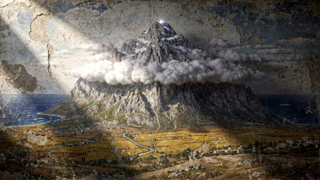
Driving north from Thessaloniki on the E75, the landscape is flat Macedonian plain for most of the journey, the road straight and the horizon unvaried. Then something appears above the treeline to the south and west that is not a hill: a mass of terrain that begins at the level of ordinary mountains and continues upward past where ordinary mountains stop, into the cloud layer that sits above the upper ridges for most of the year. By the time the road reaches the Pieria plain and the town of Litochoro is signposted, the mountain is fully visible and the scale of it has become comprehensible in the way that scale becomes comprehensible only when a human reference point is available to measure it against.
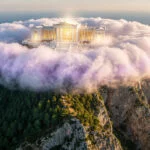
Mytikas, the highest peak, stands at 2,917 meters. The base of the mountain begins approximately at sea level, which means the full vertical rise of Olympus from the Aegean coast to its summit is close to three kilometers of continuous ascent. No other mountain in the Aegean world presents this combination: a peak of this height rising this close to the sea, in a landscape of this flatness, producing the visual effect of a mountain that appears to have no relationship to the terrain around it, as if it were placed rather than formed.
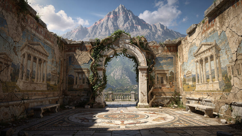
The ancient Greeks looked at this and understood that the summit was the appropriate home for the gods. The cloud layer that obscures the peak for most of the year made it simultaneously present and inaccessible, visible from the plain below and unreachable by ordinary movement through the landscape. The mountain that was always above the weather was the mountain whose summit existed in a different register from everything below it.
This article is the practical companion to the Olympus Estate mythology article on the myths of the mountain. That article covers what the Greeks believed inhabited the summit. This one covers how to reach the mountain, move through it, and understand what you are walking through.
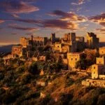
Litochoro | The Gateway Town
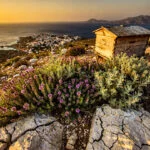
Litochoro sits at the foot of the mountain’s eastern slope at approximately 300 meters elevation, on the narrow coastal strip between the Pieria hills and the Aegean. It is a working Greek town of approximately 7,000 permanent residents that serves as the primary access point for the mountain and as the organizational hub for anyone making the ascent.
The town has a character that the summer visitor economy has modified but not entirely replaced: the kafeneion on the main square where the older men play tavli in the afternoon, the butcher and the baker and the greengrocer that serve the resident population year-round, the Orthodox church whose bell tower marks the town’s center, and the quality of a northern Greek mountain town that the Ionian and Aegean islands do not produce. Litochoro is not a resort. It is a town that has a mountain above it and that has organized itself around the mountain without being consumed by it.
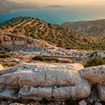
The Enipeas river gorge, the ravine that descends from the mountain through the town’s western outskirts to the sea, is one of the most accessible natural features of the Olympus landscape and one that the visitor who arrives by car or bus can walk into within twenty minutes of arriving in Litochoro. The path into the gorge begins at the town’s edge and follows the river upstream through plane trees and limestone formations for as far as the visitor chooses to continue: an hour into the gorge and back is a half-day walk that requires no technical equipment and provides the first genuine encounter with the mountain’s interior landscape.
The EOS mountaineering club office in Litochoro is the correct first stop for anyone planning a summit attempt or an extended trail visit: the club maintains current information on trail conditions, refuge availability, and the weather pattern forecasts that the mountain’s notorious afternoon thunderstorms make essential for planning.
Getting to Litochoro
From Thessaloniki, the drive is approximately 100 kilometers south on the E75, taking around 90 minutes under normal conditions. The road from Thessaloniki passes through the flat agricultural plain of central Macedonia before the Pieria hills appear to the west and the approach to Litochoro becomes visible. The town is signposted from the main road.
The intercity bus service from Thessaloniki’s KTEL Macedonia station runs regular services to Litochoro throughout the day, taking approximately two hours. The Litochoro railway station, on the coastal line between Thessaloniki and Athens, is located three kilometers from the town center and is served by the national rail network.
From Athens, the drive is approximately 350 kilometers north on the E75, taking around four hours under normal conditions. The overnight train from Athens to Litochoro is an option that the travel experience justifies independently of its practicality: the journey through the Greek mainland at night, arriving in Litochoro in the early morning with the mountain already visible above the town, is the kind of travel experience that the flight between the two cities cannot offer.
From Litochoro to the Mountain
The trailhead at Prionia, where the main ascent of Olympus begins, is approximately 18 kilometers from Litochoro by road, rising from 300 meters at the town to approximately 1,100 meters at the trailhead. The road is paved for most of its length and navigable by ordinary vehicles throughout the summer season.
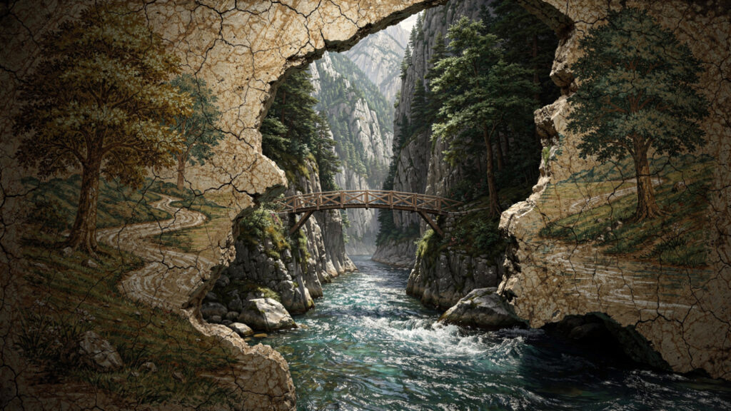
The alternative approach to Prionia is on foot through the Enipeas gorge, which follows the river from Litochoro upstream to the trailhead. This route takes approximately three hours and is the most atmospheric introduction to the mountain available: the gorge deepens as it ascends, the path crossing the river repeatedly on wooden bridges, passing beneath limestone cliffs and through the plane tree forest that lines the riverbanks, until it opens into the broader valley below Prionia. This approach adds three hours to the first day’s journey and requires no technical equipment, but it requires appropriate footwear and the awareness that the path crosses the river at multiple points where the crossing requires attention in high water.
The Trail Network
The trail system on Olympus is maintained and waymarked by the EOS and covers the full range of the mountain’s accessible terrain. Three main routes and several connecting paths give the visitor options calibrated to their experience, their physical condition, and the time they have available.
The Enipeas gorge to Spilios Agapitos is the standard approach for most visitors to the mountain’s upper zone. From Prionia at 1,100 meters, the path climbs through dense pine and fir forest for approximately three to four hours, following the ridge above the gorge and passing through the vegetation zones that the mountain’s altitude produces: the mixed forest of the lower slopes giving way to the black pine zone of the middle mountain and then to the sparse, windswept terrain of the upper approaches. The path arrives at the Spilios Agapitos refuge at 2,100 meters, where the forest ends and the open ridge begins.
The ridge from Spilios Agapitos to Mytikas is the section that requires the most attention and that produces the experience most people have come to Olympus for. From the refuge, the path continues up the open ridge toward the Skala peak at 2,866 meters, from which the final approach to Mytikas at 2,917 meters is a scramble on loose rock and exposed ledges that requires the use of hands as well as feet and a comfort with exposure to open drops. The full descent from the summit to Litochoro, which most visitors make in a single long day from Spilios Agapitos after an overnight at the refuge, takes five to seven hours depending on pace and conditions.
The Gortsia approach from the east is the quieter alternative to the main Prionia route, accessing the mountain from the village of Gortsia through terrain that receives considerably less traffic than the western approach. This route reaches the Petrostrouga refuge at approximately 2,200 meters and connects with the upper trail network, allowing a circuit of the mountain’s high zone that uses the two approaches as the outward and return legs.
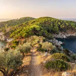
The E4 European long-distance path passes through the Olympus area and provides a lower-altitude circuit of the mountain’s foothills accessible to walkers who are not attempting the summit: a route through the olive groves and pine forests of the lower slopes, with views of the upper mountain and the Thermaikos Gulf, that takes a comfortable day and requires no technical experience.
The Refuges
The Spilios Agapitos refuge at 2,100 meters is the primary overnight stopping point for visitors making the summit attempt. It operates from mid-May through October, offers dormitory accommodation and basic meals, and sits at the point where the forest ends and the open mountain begins: the position that most directly expresses the transition between the accessible lower mountain and the terrain above it that requires serious attention.
The Christos Kakkalos refuge at 2,650 meters is the higher of the two operational refuges, positioned on the Skolio ridge close to the summit zone. It offers accommodation for those who want to reduce the summit day by staging the ascent across three days: Prionia to Spilios Agapitos on the first day, Spilios Agapitos to Christos Kakkalos on the second, Mytikas and descent on the third. This pace suits the visitor who wants to acclimatize properly and experience the upper mountain across multiple days rather than in the compressed summit push that the two-day itinerary requires.
Both refuges require advance booking in July and August when the mountain’s visitor numbers are at their peak. The Hellenic Mountaineering Federation maintains the booking system for both.
The Summit and What It Requires
The Mytikas summit is not technically difficult by the standards of Alpine mountaineering, but it is genuinely exposed and genuinely demanding by the standards of Greek mountain walking, and the combination of loose rock, steep angles, and the quality of the weather on the upper mountain in the afternoon requires that it be treated with appropriate seriousness.
The upper ridge from Skala to Mytikas is a scramble on the type of limestone that Olympus is composed of: fractured and layered, providing adequate holds when the rock is dry but becoming significantly more treacherous when it is wet or icy. The path is waymarked with red paint on the rock, but the waymarks require attention to follow in the cloud that the mountain generates rapidly and without consistent warning in the summer months.
The Louki couloir, the steep gully that provides the direct line from the trail to the Mytikas summit, is the section that requires hands-on rock and the willingness to commit to a line of ascent above a significant drop. It is not technically graded as a climbing route, but it is not a walking path. Anyone who has not scrambled on exposed mountain terrain before should either hire a local guide for this section or plan their visit as a ridge walk to Skala, which provides views equivalent to the Mytikas summit in most directions without the final exposed scramble.
The afternoon thunderstorms that develop on the upper mountain from early afternoon onward in July and August are the most significant safety consideration for anyone on the summit ridge. The cloud builds from the southwest typically between noon and two in the afternoon and reaches the upper ridge within an hour of becoming visible. The lightning that accompanies these storms on exposed limestone at 2,900 meters is genuinely dangerous and is the reason that early starts from the refuge, well before dawn for the summit attempt, are the standard practice of experienced Olympus walkers. The summit in the first light of morning, with the storm clouds still building below and the Aegean visible to the east, is a different experience from any other available on the mountain.
What the Mountain Contains
Mount Olympus is a UNESCO Biosphere Reserve, and the designation reflects a genuine ecological complexity that the mythological reputation tends to obscure. The mountain’s vertical range of almost 3,000 meters, from the coastal Mediterranean vegetation of the lower slopes to the alpine zone of the upper ridges, produces a diversity of plant and animal communities that no other single site in Greece contains.
The endemic plant species of Olympus include Jankaea heldreichii, a plant in the Gesneriaceae family found only on the shaded north-facing limestone cliffs of the upper mountain, and several species of Viola and Centaurea endemic to the mountain’s geological and climatic conditions. The wildflowers of the lower and middle slopes in May and June, before the summer dryness reduces the vegetation to its dry-season palette, are among the most varied in the Aegean region: the combination of altitude, aspect, and soil chemistry that the mountain’s different zones produce supporting plant communities that the botanist Halácsy described in the late nineteenth century as among the most interesting in the eastern Mediterranean.
The brown bears that inhabit the broader Pierian mountains of which Olympus is part are not commonly encountered on the main trails but are present in the forest of the middle slopes. The golden eagle that patrols the upper ridges is the most visible of the mountain’s raptors and the one most frequently seen from the trail between Spilios Agapitos and the summit zone: a large bird using the thermals that the sun on the limestone ridges generates, circling at heights that make its scale difficult to judge until it passes closer to the observer.
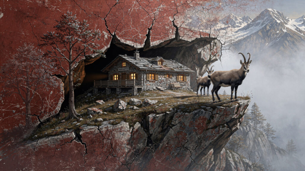
The chamois, the mountain goat of the upper zone, is found above 2,000 meters on the rocky terrain that provides the combination of escape routes and grazing that the species requires. Groups of three or four animals are not uncommon on the open ridges between the refuges and the summit, and the quality of an encounter with chamois on the upper mountain, the animals watching from a ledge above the trail with the composure of animals that have never needed to fear human presence, is the encounter that most directly communicates the mountain’s character as a place where the human and the natural world exist in a particular kind of proximity.
Dion | The Sacred City Below
The archaeological site of Dion, 17 kilometers south of Litochoro on the plain between Olympus and the sea, is the companion visit to the mountain itself for anyone who wants to understand the full relationship between the ancient world and this landscape.
Dion was the sacred city of the Macedonians, the place where the Macedonian kings performed their rites before war, where Alexander the Great made his offerings to the Olympian gods before departing on the campaign that would take him to the Indus, and where the theatrical and athletic festivals that honored the gods of Olympus were held in the most direct geographic relationship to the mountain that a human settlement could maintain.
The archaeological site is extensive and significantly undervisited relative to its importance: the sanctuaries of Zeus, Demeter, and Isis, the theater, the baths, the residential quarter with its mosaic floors, and the combination of Greek and later Roman material that documents the site’s continuous occupation from the archaic period through the late Roman era. The museum at Dion holds the hydraulic organ, one of the most extraordinary objects in the Greek archaeological record: a third-century BCE instrument whose principle of operation, water pressure stabilizing the air supply to a set of pipes, is documented in the machine itself and in the theoretical writings of Hero of Alexandria.
The view of Olympus from Dion, looking north across the flat plain to the mountain that the sanctuary was oriented toward, is the view that the ancient world understood as the relationship between the human sacred space and the divine residence above it: the city below and the mountain above, connected by the religious practice that the one performed in honor of the beings it believed inhabited the other.
When to Come
The mountain is accessible for trail walking from May through October, with the summit route typically requiring the full snow clearance of the upper zone that early June provides. The optimal weeks are late May, when the wildflowers of the lower and middle slopes are at their most varied and the summer crowds have not yet arrived, and September, when the heat of August has moderated and the visibility on the upper mountain is typically at its clearest.
July brings the Olympus Festival to Litochoro, a series of open-air theatrical and musical performances that the town hosts in the tradition of combining artistic celebration with the landscape of the mountain that the ancient world also maintained. The festival extends through most of the month and provides the visitor who times their stay to coincide with it a dimension of the Olympus experience that the trail alone cannot provide.
August is the month when the mountain receives its maximum visitor numbers, the refuges are at their fullest, and the afternoon thunderstorms are at their most consistent. The summit in August requires the earliest possible start, the most careful attention to the developing weather, and the acceptance that the trail between the refuge and the summit will be shared with a significant number of other people making the same decision.
October is the mountain in its autumn character: the lower forest in the colors of the Macedonian autumn, the upper zone clear and cold, the refuges approaching the end of their season and the trails quieter than at any point since May. The chamois on the upper ridge in October, with the Aegean visible below and the first snow possible on the summit, is one of the most complete images of what the mountain is when it is not performing for its visitors.
At Olympus Estate, Wanderlust Greece guides you across the sacred and storied terrain of the Hellenic world. For the mythology of the mountain, the full account of Zeus, the Olympian court, the Titanomachy, and Dion’s sacred history, the companion article in Tales from Olympus develops what the ancients believed inhabited the summit. This article covers how to reach it. Both are necessary.


